Parkers Crossroads in Henderson County, Tennessee — The American South (East South Central)
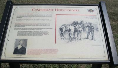
Confederate Horseholders
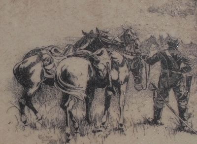
Forrest's Cavalry fought dismounted at the Battle of Parker's Crossroads, as was customary. Cavalry depended upon their mounts and military protocol defined how horses were handled in battle. One of every four horsemen remained mounted and took control of the horses of the three dismounted men. The "horseholders" kept to the rear, away from the battle but ready to bring the horses forward if ordered to do so.
The horseholders of Colonel George Dibrell's and Major Nicholas Cox's battalions were in the orchard and field behind the Parker house when Colonel John Fuller's Ohio Brigade came within sight of the battlefield.
Three Ohio Regiments swept down from the ridge and into the fields behind the Parker house while Fuller's gunners rained shot and shell on the Confederate batteries. The Ohioans' quick advance took the horseholders, whose attention was on the apparent surrender taking place ¼ mile south, completely by surprise.
In the ensuing melee, the Confederate horseholders lost control of the mounts and were forced to abandon them. Many of the stampeding horses were later rounded up by Fuller's men.
Lieutenant Colonel Zephaniah S. Spaulding, 27th Ohio, reported, "By order of Colonel Fuller I formed my line on the left of the road, fixed bayonets, and charged down the road and across the open fields which lay between us and the enemy. In an orchard we found a large number of rebel cavalry horses, with equipments, &c., complete, being held by a detail made for that purpose, all of which we captured."
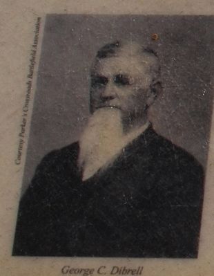
(Inset: Portrait of George C. Dibrell)
"We had about 300 prisoners, and while we were parlaying about a surrender the enemy was re-enforced by General Sullivan with another brigade of infantry, which was firing upon our horse-holders before we were aware of his approach. General Forrest then ordered us to retreat, which we did in much confusion, as our horse-holders were demoralized, and many men captured in trying to get their horses." — Colonel George C. Dibrell, 8th Tennessee Cavalry
Erected by Parker's Crossroads Battlefield Association.
Topics. This historical marker is listed in this topic list: War, US Civil.
Location. 35° 47.679′ N, 88° 23.253′ W. Marker is in Parkers Crossroads, Tennessee, in Henderson County. Marker can be reached from Tennessee Route 22, 0.6 miles north of Interstate 40, on the right when traveling north. Marker is on the North Loop Walking Trail 0.4 miles from the start of the trail excluding the eastern extension. The North Loop Walking Trail is at Tour Stop #1 (Parkers Crossroads City Park) of the Driving Tour. Touch for map. Marker is in this post office area: Wildersville TN 38388, United States of America. Touch for directions.
Other nearby markers. At least 8 other markers are within walking distance of this marker. The Battle Begins (about 300 feet away, measured in a direct line); Fuller's Assault (about 400 feet away); Forrest's Big Show (about 400 feet away); Prelude to Battle/December 31, 1862—the Battle/Union and Confederate Forces (about 500 feet away); Manning the Guns (about 500 feet away); Civil War Artillery (about 500 feet away); "Give 'Em Hell" (about 600 feet away); "Charge Them Both Ways" (about 600 feet away). Touch for a list and map of all markers in Parkers Crossroads.
Regarding Confederate Horseholders. The marker includes a drawing: Union horseholder at Gettysburg.
Additional keywords. Parkers Crossroads
Credits. This page was last revised on June 4, 2021. It was originally submitted on March 16, 2014, by David Graff of Halifax, Nova Scotia. This page has been viewed 521 times since then and 13 times this year. Photos: 1. submitted on March 16, 2014, by David Graff of Halifax, Nova Scotia. 2, 3. submitted on August 22, 2015, by Brandon Fletcher of Chattanooga, Tennessee. 4. submitted on March 16, 2014, by David Graff of Halifax, Nova Scotia. • Bernard Fisher was the editor who published this page.


