Near Thamesville in Chatham-Kent, Ontario — Central Canada (North America)
The Bugles Sound
Tuesday, October 5, 1813, 4:00 p.m.
| — | Tecumseh Parkway | — |
Photographed by Dale K. Benington, July 23, 2013
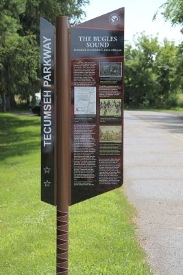
1. The Bugles Sound Marker
View, looking south, of the English text side of the historical marker.
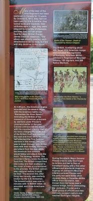
The British, numbering about 450, faced 3000 American troops that included five regiments of Kentucky Volunteer Militia, Johnson's Regiment of Mounted Infantry, 120 regulars, and 200 Native Warriors.
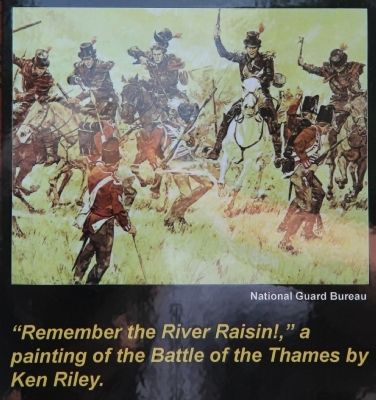
At 4:00 p.m., the American bugles sounded and the assault began with the American battle cry, "Remember the River Raisin!" reminding the British of the massacre of American prisoners by warriors under Procter's command earlier in the year. Colonel Johnson led the attack with his mounted infantry. Half of his force charged the south end of the British front line (nearest the road and river) while the other half attacked the First Nations warriors in the marsh. The plan was to break through both British lines with their horses, dismount, and attack from the rear, while the American foot soldiers would follow and attack from the front. The strategy worked. The mounted infantry broke the British front line. The British troops fired one volley and then scattered to the cover of trees or surrendered. In the process, the British cannon was captured before it could be fired. The second line, after firing two rounds, was similarly broken by the U.S. horsemen. The forward action was over in minutes with 12 British killed, 22 wounded, and three Americans dead.
During the attack, Major General Procter tried to rally the troops to re-form but had to flee on horseback along with a few other
this page online
Erected by Tecumseh Parkway.
Topics. This historical marker is listed in these topic lists: Colonial Era • Indigenous Peoples and Communities • War of 1812. A significant historical date for this entry is October 5, 1813.
Location. 42° 33.85′ N, 81° 55.846′ W. Marker is near Thamesville, Ontario, in Chatham-Kent. It can be reached from Longwoods Road (Provincial Highway 2) 4.2 kilometers east of Victoria Road (Provincial Highway 21), on the right when traveling east. The historical marker is located in a Historical Park, that commemorates the Battle of the Thames, along the east side of a park roadway with a long series of Tecumseh Parkway markers. Touch for map. Marker is at or near this postal address: 14376 Longwoods Road, Thamesville ON N0P 2K0, Canada. Touch for directions.

Regionally,
Photographed by Dale K. Benington, July 23, 2013
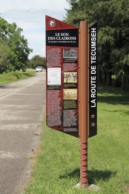
2. The Bugles Sound Marker
View, looking north, of the French text side of the historical marker.
Other nearby markers. At least 8 other markers are within walking distance of this marker: Assault on Backmetack Marsh (a few steps from this marker); The Death of Tecumseh (a few steps from this marker); a different marker also named Participants in the Battle of the Thames (within shouting distance of this marker); a different marker also named Participants in the Battle of the Thames (within shouting distance of this marker); a different marker also named Participants in the Battle of the Thames (within shouting distance of this marker); a different marker also named Participants in the Battle of the Thames (within shouting distance of this marker); a different marker also named Participants in the Battle of the Thames (within shouting distance of this marker); Why Choose This Site? (about 90 meters away, measured in a direct line). Touch for a list and map of all markers in Thamesville.
Another marker is no longer nearby. Participants in the Battle of the Thames (was a few steps from this marker but has been confirmed missing).
Photographed by Dale K. Benington, July 23, 2013
3. The Bugles Sound Marker
A close-up view of the English text side of the historical marker.
Photographed by Dale K. Benington, July 23, 2013
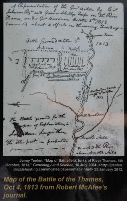
4. The Bugles Sound Marker
A close-up view of a map of the Battle of the Thames, October 4, 1813, from Robert McAfee's journal, that is displayed on the historical marker.
Photographed by Dale K. Benington, July 23, 2013
5. The Bugles Sound Marker
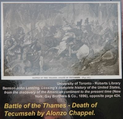
A close-up view of a print showing the Battle of the Thames - Death of Tecumseh by Alonzo Chappel, that is displayed on the historical marker.
Photographed by Dale K. Benington, July 23, 2013
6. The Bugles Sound Marker
A close-up view of a painting of the Battle of the Thames, entitled "Remember the River Raisin!," by Ken Riley, that is displayed on the historical marker.
Photographed by Dale K. Benington, July 23, 2013
7. The Bugles Sound Marker
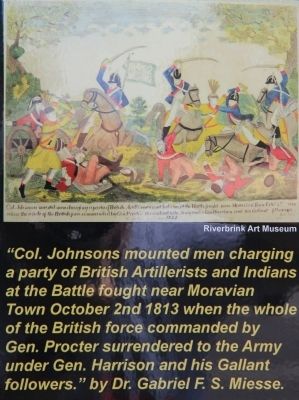
A close-up view of a print of the Battle of the Thames by Dr. F. S. Miesse, that is displayed on the historical marker.
Photographed by Dale K. Benington, July 23, 2013
8. The Bugles Sound Marker
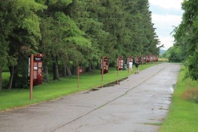
View of the short park roadway that is lined with a series of Tecumseh Parkway historical markers, including this featured historical marker.
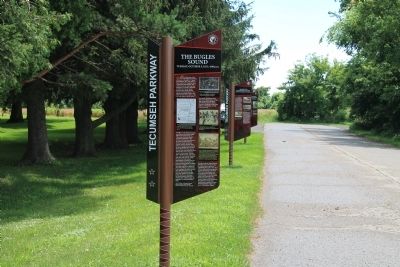
Photographed by Dale K. Benington, July 23, 2013
9. The Bugles Sound Marker
View, looking south, of the featured historical marker, located as the ninth marker from the beginning of a series of Tecumseh Parkway historical markers.
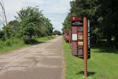
Photographed by Dale K. Benington, July 23, 2013
10. The Bugles Sound Marker
View, looking north, of the featured historical marker, located as the ninth marker from the beginning of a series of Tecumseh Parkway historical markers.
Photographed by Dale K. Benington, July 23, 2013
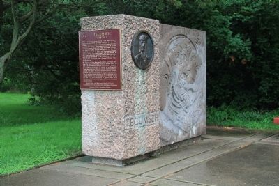
11. Tecumseh Memorial
View of the nearby Tecumseh Memorial.
Credits. This page was last revised on September 27, 2019. It was originally submitted on March 17, 2014, by Dale K. Benington of Toledo, Ohio. This page has been viewed 755 times since then and 22 times this year. Photos: 1, 2, 3, 4, 5, 6, 7, 8, 9, 10, 11. submitted on March 18, 2014, by Dale K. Benington of Toledo, Ohio.
