Sharpsburg in Washington County, Maryland — The American Northeast (Mid-Atlantic)
Reserve Artillery, Longstreet's Command
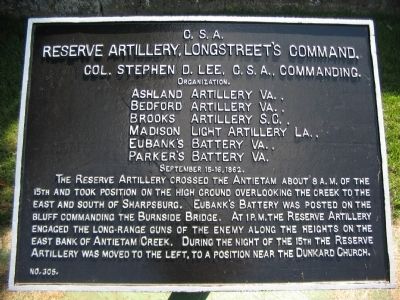
Reserve Artillery, Longstreet's Command,
Col. Stephen D. Lee, C.S.A., Commanding.
Organization.
Ashland Artillery Va.,
Bedford Artillery Va.,
Brooks Artillery S.C.,
Madison Light Artillery La.,
Eubank's Battery Va.,
Parker's Battery Va.
September 15-16, 1862.
The Reserve Artillery crossed the Antietam about 8 a.m. of the 15th and took position on the high ground overlooking the creek to the east and south of Sharpsburg. Eubank's Battery was posted on the bluff commanding the Burnside Bridge. At 1 p.m. the Reserve Artillery engaged the long-range guns of the enemy along the heights on the east bank of Antietam Creek. During the night of the 15th the Reserve Artillery was moved to the left, to a position near the Dunkard Church.
Erected by Antietam Battlefield Board. (Marker Number 305.)
Topics and series. This historical marker is listed in this topic list: War, US Civil. In addition, it is included in the Antietam Campaign War Department Markers series list. A significant historical month for this entry is September 1704.
Location. 39° 27.596′ N, 77° 44.547′ W. Marker is in Sharpsburg, Maryland, in Washington County. Marker is on Boonsboro Pike (State Highway 34), on the right when traveling east. Located in a Confederate tablet cluster just to the west of the National Cemetery entrance, stop eleven of the driving tour of Antietam Battlefield. Touch for map. Marker is in this post office area: Sharpsburg MD 21782, United States of America. Touch for directions.
Other nearby markers. At least 8 other markers are within walking distance of this marker. Hood's Division, Longstreet's Command (here, next to this marker); Longstreet's Command (here, next to this marker); a different marker also named Longstreet's Command (here, next to this marker); a different marker also named Longstreet's Command (here, next to this marker); a different marker also named Longstreet's Command (a few steps from this marker); D.R. Jones' Division, Longstreet's Command (a few steps from this marker); a different marker also named D.R. Jones' Division, Longstreet's Command (a few steps from this marker); Evans' Brigade, Longstreet's Command (within shouting distance of this marker). Touch for a list and map of all markers in Sharpsburg.
Also see . . .
1. Antietam Battlefield. National Park Service site. (Submitted on April 20, 2008, by Craig Swain of Leesburg, Virginia.)
2. Second Battalion, Longstreet's Reserve Artillery. Col. Lee described the action on the 15th: The enemy soon brought up several long-range batteries, with which they opened on our guns whenever they fired on their infantry. Nothing

Photographed By Craig Swain
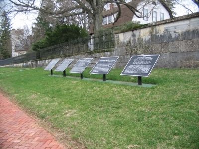
2. Confederate Tablet Cluster near the Entrance to the Cemetery
From left to right these are: Longstreet's Command, September 14-16 (number 303); Longstreet's Command, September 17 (number 304); Reserve Artillery, Longstreet's Command, September 15-16 (number 305); Hood's Division, September 15-16 (number 309); and Reserve Artillery, Hood's Division, September 15-16 (number 311). Three additional tablets stand to the right of these.

Photographed By Craig Swain, August 31, 2008
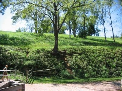
3. High Ground Overlooking Burnside Bridge
On September 15, before the main battle, Eubank's Battery was posted on the high ground overlooking the bridge. Later the battery, with the rest of the reserve artillery, was relocated to a point close to the Dunkard Church.
Credits. This page was last revised on November 24, 2017. It was originally submitted on April 20, 2008, by Craig Swain of Leesburg, Virginia. This page has been viewed 989 times since then and 8 times this year. Photos: 1, 2. submitted on April 20, 2008, by Craig Swain of Leesburg, Virginia. 3. submitted on December 5, 2008, by Craig Swain of Leesburg, Virginia.
