Belleek in Fermanagh And Omagh, Northern Ireland, United Kingdom — Northwestern Europe (the British Isles)
Donegal Corridor
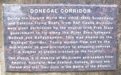
During the Second World War (1939-1945) Sunderland and Catalina Flying Boats from RAF Castle Archdale were given permission by the neutral Irish Free State government to fly along the River Erne between Belleek and Ballyshannon. This was known as the Donegal Corridor. Young airmen flew out to the mid-Atlantic to give protection to shipping convoys. A number of planes crashed in the locality.
This plaque is in memory of the airmen and seamen from America, Australia, New Zealand, Canada, Britain and Ireland who lost their lives in the Battle of the Atlantic.
Topics. This memorial is listed in these topic lists: Air & Space • Patriots & Patriotism • War, World II • Waterways & Vessels.
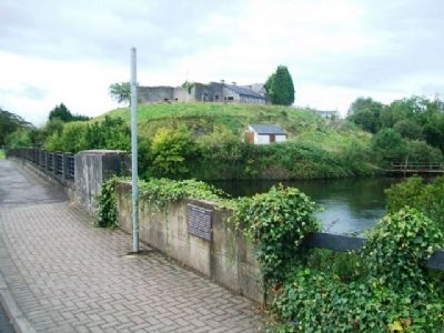
Location. 54° 28.751′ N, 8° 5.639′ W. Marker is in Belleek, Northern Ireland, in Fermanagh And Omagh. Memorial is at the intersection of Main Street (A47) and the entrance to the Belleek Pottery Factory, on the left when traveling north on Main Street (A47). Marker is on the northern end of the bridge over the River Erne. Touch for map. Marker is at or near this postal address: 3 Main Street, Belleek, Northern Ireland BT93 3FY, United Kingdom. Touch for directions.
Other nearby markers. At least 7 other markers are within 21 kilometers of this marker, measured as the crow flies. Welcome to Belleek (a few steps from this marker); The Enamel Grindstone (within shouting distance of this marker); The Franciscan Friary of Donegal (approx. 19.1 kilometers away in Ireland); Donegal Friary / Mainistir Dhún na nGall (approx. 19.2 kilometers away in Ireland); "The Frenchman's Anchor" (approx. 19.3 kilometers away in Ireland); Donegal Castle / Caisleán Dhún na nGall (approx. 19.6 kilometers away in Ireland); Donegal Castle (approx. 19.6 kilometers away in Ireland).
Also see . . .
1. The Donegal corridor and the Battle of the Atlantic. (Submitted on March 23, 2014, by William Fischer, Jr. of Scranton, Pennsylvania.)
2. WW2 Cataling flying boats return to Fermanagh base (BBC 2011). (Submitted on March 23, 2014, by William Fischer, Jr. of Scranton, Pennsylvania.)
Credits. This page was last revised on July 24, 2018. It was originally submitted on March 23, 2014, by William Fischer, Jr. of Scranton, Pennsylvania. This page has been viewed 544 times since then and 21 times this year. Photos: 1, 2. submitted on March 23, 2014, by William Fischer, Jr. of Scranton, Pennsylvania.

