South Beach in San Francisco City and County, California — The American West (Pacific Coastal)
Steamboat Point
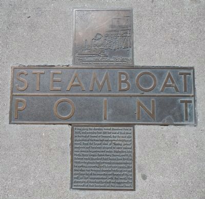
Photographed by Barry Swackhamer, March 20, 2014
1. Steamboat Point Marker
Erected by San Francisco Art Commission for the Waterfront Transportation Projects.
Topics. This historical marker is listed in this topic list: Waterways & Vessels. A significant historical year for this entry is 1851.
Location. 37° 46.687′ N, 122° 23.486′ W.
this page online

Regionally, this marker is on the Coast Ranges. It is also on the American Pacific Coast. Globally, it is in North America, on the Ring of Fire, on the Pacific Rim, in the Western Hemisphere, in the Western World, and in the Anglosphere. Historically, it finds itself in what was once New Spain and also Mexico’s Alta California.
Other nearby markers. At least 8 other markers are within walking distance of this marker: Willie Howard Mays, Jr. (a few steps from this marker); a different marker also named Willie Howard Mays, Jr. (within shouting distance of this marker); Willie McCovey (within shouting distance of this marker); Southbeach Shoreline – 1852 (about 300 feet away, measured in a direct line); Ryan Vogelsong (about 400 feet away); Barry Bonds (about 400 feet away); J.T. Snow (about 400 feet away); Brian Wilson
Photographed by Barry Swackhamer, March 20, 2014
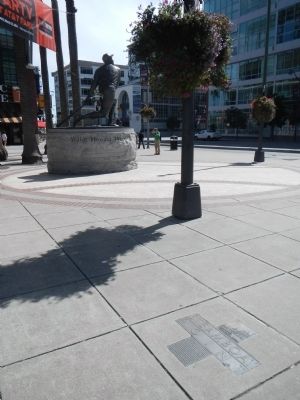
2. Steamboat Point Marker
Statue of Willie Mays, Jr. in the background.
More about this marker. This marker is embedded in the sidewalk at AT&T Park's Willie Mays Plaza.
Credits. This page was last revised on February 7, 2023. It was originally submitted on March 24, 2014, by Barry Swackhamer of Brentwood, California. This page has been viewed 710 times since then and 37 times this year. Photos: 1, 2. submitted on March 24, 2014, by Barry Swackhamer of Brentwood, California. • Bill Pfingsten was the editor who published this page.
