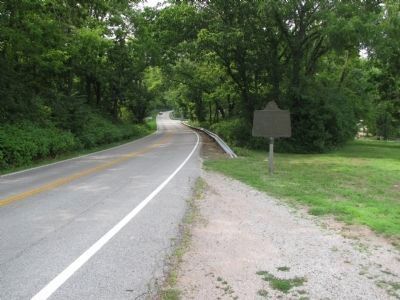
Near Richmond in Madison County, Kentucky — The American South (East South Central)
Col. Richard Callaway / First Ferry in Kentucky
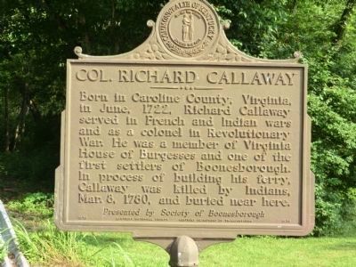
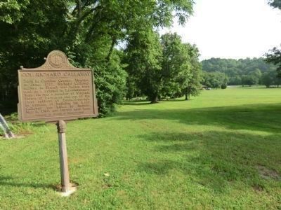
Col. Richard Callaway. Born in Caroline County, Virginia, in June 1722, Richard Callaway served in French and Indian wars and as a colonel in Revolutionary War. He was a member of Virginia House of Burgesses and one of the first settlers of Boonesborough. In process of building his ferry, Callaway was killed by Indians, Mar. 8, 1780, and buried near here.
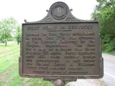
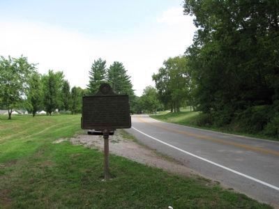
First Ferry in Kentucky. License for first ferry established in state, Oct. 1779, was granted to Col. Richard Callaway by the Virginia legislature. The fare for a man or a horse was three shillings (50 cents). Ferry operated until 1931, when present bridge was constructed. Its last owner was Colonel David J. Williams. Ferry road remains nearby.
Erected 1976 by Kentucky Historical Society, Kentucky Department of Highways; presented by Society of Boonesborough. (Marker Number 1578.)
Topics and series. This historical marker is listed in these topic lists: Settlements & Settlers • War, French and Indian • War, US Revolutionary. In addition, it is included in the Kentucky Historical Society series list. A significant historical month for this entry is June 1722.
Location. 37° 53.817′ N, 84° 16.033′ W. Marker is near Richmond, Kentucky, in Madison County . Marker is on Boonesboro Road (Kentucky Route 388) south of Boonesborough Road (Kentucky Route 627), on the right when traveling north. This marker stands in Fort Boonesborough State Park. Touch for map. Marker is in this post office area: Richmond KY 40475, United States of America. Touch for directions.
Other nearby markers. At least 8 other markers are within walking distance of this marker. First Ferry in Kentucky / Col. Richard Callaway (a few steps from this marker); Nathaniel Hart / Home of Capt. Nathaniel Hart (about 500 feet away, measured in a direct line); Fort Boonesborough (about 500 feet away); The First Christian Service in Kentucky (approx. 0.2 miles away); Pioneer National Monument Association (approx. 0.2 miles away); Building Fort Boonesborough (approx. 0.2 miles away); Boone Trace (approx. 0.2 miles away); Fort Boonesborough Revealed (approx. 0.2 miles away). Touch for a list and map of all markers in Richmond.
Also see . . . Col Richard Callaway at FindAGrave.com. (Submitted on September 18, 2013, by Mike Wintermantel of Pittsburgh, Pennsylvania.)
Credits. This page was last revised on November 22, 2023. It was originally submitted on August 17, 2013, by Don Morfe of Baltimore, Maryland. This page has been viewed 1,304 times since then and 37 times this year. Last updated on March 27, 2014, by Lee Hattabaugh of Capshaw, Alabama. Photos: 1. submitted on August 17, 2013, by Don Morfe of Baltimore, Maryland. 2. submitted on March 28, 2014, by Lee Hattabaugh of Capshaw, Alabama. 3. submitted on August 17, 2013, by Don Morfe of Baltimore, Maryland. 4, 5. submitted on March 28, 2014, by Lee Hattabaugh of Capshaw, Alabama. • Bill Pfingsten was the editor who published this page.
