
Colwood in Capital Region, British Columbia — Canada’s West Coast (North America)
Colwood Pioneer Cemetery
Photographed by Andrew Lester, January 1, 2014
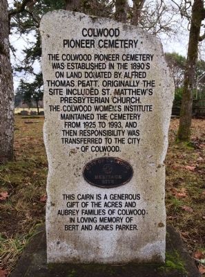
1. Colwood Pioneer Cemetery Marker
This cairn is a generous gift of the Acres and Aubrey families of Colwood in loving memory of Bert and Agnes Parker.
Topics. This historical marker is listed in this topic list: Cemeteries & Burial Sites. A significant historical year for this entry is 1925.
Location. 48° 26.298′ N, 123° 29.268′ W. Marker is in Colwood, British Columbia, in Capital Region. It can be reached from the intersection of Glencairn Lane and Yeta Terrace, on the right when traveling north. Touch for map. Marker is in this post office area: Colwood BC V9B, Canada. Touch for directions.

Regionally, it is in North America, on the Ring of Fire, in the Pacific Rim, in the Western Hemisphere, in the Western World, and in the Anglosphere. Historically, it finds itself in what was once a British colony.
Other nearby markers. At least 8 other markers
this page online
Photographed by Andrew Lester, January 1, 2014
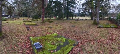
2. Colwood Pioneer Cemetery
Credits. This page was last revised on June 16, 2016. It was originally submitted on January 1, 2014, by Andrew Lester of Victoria, BC, Canada. This page has been viewed 917 times since then and 20 times this year. Last updated on April 7, 2014, by Barry Swackhamer of Brentwood, California. Photos: 1, 2. submitted on January 1, 2014, by Andrew Lester of Victoria, BC, Canada. • Bill Pfingsten was the editor who published this page.
