Near Spotsylvania Courthouse in Spotsylvania County, Virginia — The American South (Mid-Atlantic)
Warren's Line
The Battle of Spotsylvania Court House
Photographed by Craig Swain, March 16, 2014
1. Warren's Line Marker
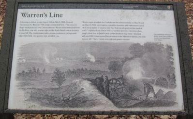
The illustration on the marker is captioned, This engraving from Harper's Weekly shows Union artillerists in action against Spotsylvania Court House.
Warren again attacked the Confederate line unsuccessfully on May 10 and on May 12. With each repulse, casualties mounted and enthusiasm waned. "It is not a matter of surprise that they had lost all spirit for that kind of work," explained one Union officer, "as their previous experience had taught them that to [attack] was certain death on that front." Stymied at Laurel Hill, Grant turned his attention to the Muleshoe Salient, one mile to your left. There, Union arms enjoyed greater success.
Erected by National Park Service, U.S. Department of the Interior.
Topics. This historical marker is listed in this topic list: War, US Civil. A significant historical month for this entry is May 1850.
Location. 38° 12.94′ N, 77° 37.126′ W. Marker is
this page online

Regionally, this marker is in the Washington Metropolitan Area, in Northern Virginia, and in the Piedmont. It is also in the American South, specifically in the Upper South, in the Mid-Atlantic, and on the Eastern Seaboard. Globally, it is in the North Atlantic Region, North America, the Western Hemisphere, the Western World, and the Anglosphere. Historically, it finds itself in what was once the territory of the Mississippian Culture, one of the original Thirteen Colonies, one of the Confederate States of America, and the Antebellum South.
Other nearby markers. At least 8 other markers are within walking distance of this marker: Spindle House (approx. 0.2 miles away); Laurel Hill (approx. ¼ mile away); The Race for Spotsylvania Court House (approx. ¼ mile away); The Death of Sedgwick
Photographed by Craig Swain, March 16, 2014
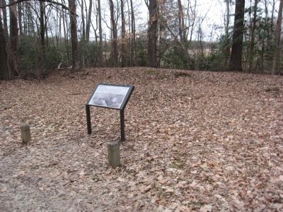
2. Warren's Line Marker
Other markers no longer nearby. Spotsylvania Campaign (was approx. 0.2 miles away but has been permanently removed); a different marker also named The Spindle House (was approx. 0.2 miles away but has been permanently removed); a different marker also named Spotsylvania Campaign (was approx. 0.3 miles away but has been permanently removed); a different marker also named Spotsylvania Campaign (was approx. 0.3 miles away but has been permanently removed); Maryland Monument (was approx. 0.3 miles away but has been permanently removed).
Photographed by Craig Swain, March 16, 2014
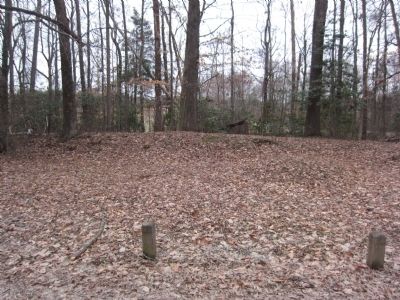
3. Portion of the artillery earthworks in front of the marker
Credits. This page was last revised on July 9, 2021. It was originally submitted on April 7, 2014, by Craig Swain of Leesburg, Virginia. This page has been viewed 793 times since then and 28 times this year. Photos: 1, 2, 3. submitted on April 7, 2014, by Craig Swain of Leesburg, Virginia.
