Waikiki in Honolulu in Honolulu County, Hawaii — Hawaiian Island Archipelago (Pacific Ocean)
The Beaches of Waikiki
Waikiki Historic Trail
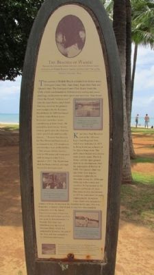
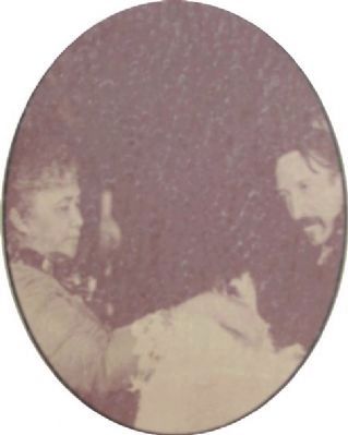
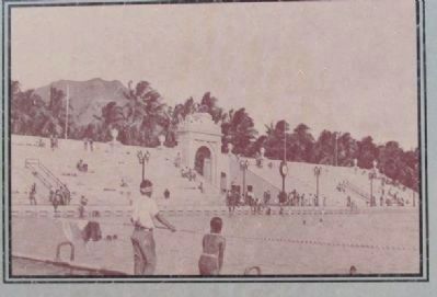
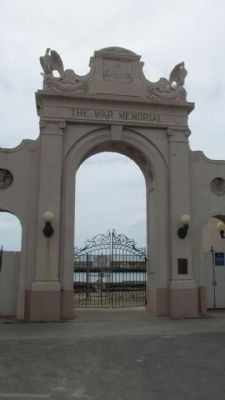
This section of Waikiki Beach contains four distinct areas: Outrigger Canoe Club, San Souci, Kapi’olani Park and Queen’s Surf. The Outrigger Canoe Club Beach fronts the Club, which was founded in 1908 to revive surfing and canoe paddling, and to promote other sports and activities. Sans Souci (from the French “without care”) takes its name from a small hotel that once stood on the grounds now occupied by the Kaimana Beach Hotel. In 1893 the famed Scottish writer Robert Louis Stevenson spent five weeks convalescing at Sans Souci. He praised the hotel for its “lovely scenery, quiet, pure air, clear sea water, good food, and heavenly sunset….” Next to San Souci is the War Memorial Natatorium, a monument to the 179 island men who lots their lives in World War I. This unique athletice facility, with its 100 meter salt-water pool (still the largest in the U.S.), opened in 1927. The Natatorium arch has been restored, although the pool is no longer used.
Kapi’olani Park Beach is part of the 100 acre Kapi’olani Regional Park which was dedicated in 1877 by King Kalakaua in honor of his Queen Kapi’olani. The park’s main feature was a horse track in early years. The U.S. Army used the open ground there as an encampment after the annexation of Hawaii in 1898. The Queen’s Surf was one of the most popular restaurant-nightclubs in Honolulu during the 1950s and 1960s for both visitors and residents. It was named for the famous surf break of shore. The structure was demolished in 1971 to make room for park improvements.
In ancient times, there were at least two temples or heiau located near the shoreline in this area. Once was Kupalaha, at Queen’s Surf Beach. It may have functioned in connection with the famed Pap’ena’ena heiau where it is believed the last human sacrifice was made by Kamehameha I in Waikiki. The other was Makahuna near the foot of Diamond Head, which was dedicated to Kanaloa, the god of the Seas, and was attended to by fisherman and seaman.
Erected by Shiraham Tourism Association of Wakayama Prefecture, Japan. (Marker Number 1.)
Topics. This historical marker is listed in these topic lists: Parks & Recreational Areas • Sports • Waterways & Vessels. A significant historical date for this entry is February 3, 1887.
Location. 21° 16.235′ N, 157° 49.353′ W. Marker is in Honolulu, Hawaii, in Honolulu County. It is in Waikiki. Marker is on Kalaukaua Ave, on the left when traveling west. Located in Kuhio Beach Park across the Y intersection of Monsarrat and Kalakaua Ave. Touch for map. Marker is at or near this postal address: Kalaukaua Ave, Honolulu HI 96815, United States of America. Touch for directions.
Other nearby markers. At least 8 other markers are within walking distance of this marker. Waikiki (about 400 feet away, measured in a direct line); Prince Jonah Kuhio Kalaniana’ole (approx. 0.2 miles away); Duke Paoa Kahanamoku (approx. 0.4 miles away); The Stones Of Life (approx. 0.4 miles away); The First Lady of Waikiki (approx. half a mile away); Victoria Kawekiu F Lunalilo Kalaninuiahilapalapu Ka’iulani Cleghorn (approx. half a mile away); Mahiole (approx. 0.8 miles away); Kawehewehe (approx. 0.8 miles away). Touch for a list and map of all markers in Honolulu.
Regarding The Beaches of Waikiki. Second photo caption: The Ka'ckaunahe Stream once flowed through Kapahulu Avenue and emptied into the bay at Kuhio Beach. Photo taken in 1886.
Third photo caption: The Queen's Surf was a popular nightspot from the 1950's until it was demolished amid much controversy in 1971.
Credits. This page was last revised on February 10, 2023. It was originally submitted on April 21, 2014, by Denise Boose of Tehachapi, California. This page has been viewed 632 times since then and 59 times this year. Photos: 1, 2, 3, 4, 5, 6, 7, 8, 9. submitted on April 21, 2014, by Denise Boose of Tehachapi, California. • Bill Pfingsten was the editor who published this page.
