Muskogee in Muskogee County, Oklahoma — The American South (West South Central)
State's Earliest Oil Refinery
Photographed by William Fischer, Jr., March 10, 2014
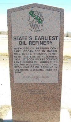
1. State's Earliest Oil Refinery Marker
Muskogee Oil Refining Company, organized in March 1905, built a finishing plant near this site in November, 1904. It soon was producing lamp kerosene, lubricating oil and industrial fuel - the beginning of oil refining in Oklahoma, a leading industry today.
Erected 1995 by Oklahoma Historical Society. (Marker Number 73.)
Topics and series. This historical marker is listed in these topic lists: Environment • Industry & Commerce • Man-Made Features • Settlements & Settlers. In addition, it is included in the Oklahoma Historical Society series list. A significant historical month for this entry is March 1905.
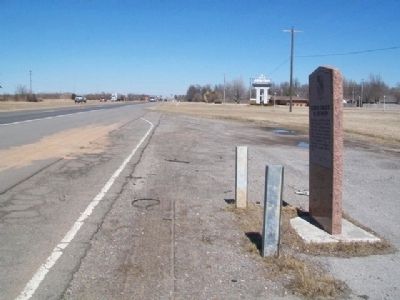
Location. 35° 43.693′ N, 95° 24.146′ W. Marker is in Muskogee, Oklahoma, in Muskogee County. It is on 32nd Street (U.S. 54/69) 0.2 miles north of Hancock Street, on the right when traveling north. Marker is at a roadside pullout. Touch for map. Marker is at or near this postal address: 2200 South 32nd Street, Muskogee OK 74401, United States of America. Touch for directions.

Regionally, this marker is in the Muscogee Nation, specifically in the Cherokee Nation, and in Northeast Oklahoma—Green Country. It is also in the American South, specifically on the prairies, and on the Southern Plains. Globally, it is in North America, the Western Hemisphere, the Western World, and the Anglosphere. Historically, it finds itself in what was once the territory of the Mississippian Culture and also the Louisiana Purchase.
Other nearby markers. At least 8 other markers are within 2 miles of this marker, measured as the crow flies: Marland Oil Gas Station (approx. 1.9 miles away); Thomas-Foreman House (approx. 2 miles away); Jefferson Highway Route through Muskogee (approx. 2 miles away); The Welch Home (approx. 2 miles away); The George Murphy Home (approx. 2 miles away); The Coss Home (approx.
this page online
Photographed by William Fischer, Jr., March 10, 2014
2. State's Earliest Oil Refinery Marker
Credits. This page was last revised on September 24, 2020. It was originally submitted on April 21, 2014, by William Fischer, Jr. of Reynoldsburg, Ohio. This page has been viewed 1,081 times since then and 63 times this year. Photos: 1, 2. submitted on April 21, 2014, by William Fischer, Jr. of Reynoldsburg, Ohio.
