Checotah in McIntosh County, Oklahoma — The American South (West South Central)
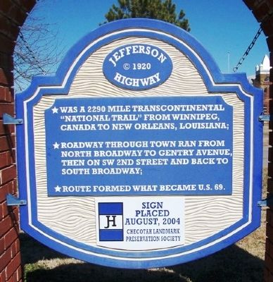
Jefferson Highway
c. 1920
• Was a 2290 mile transcontinental "National Trail" from Winnipeg, Canada to New Orleans, Louisiana;
• Roadway through town ran from North Broadway to Gentry Avenue, then on SW 2nd Street and back to South Broadway;
• Route formed what became U.S. 69.
Sign placed August, 2004
Erected 2004 by Checotah Landmark Preservation Society.
Topics. This historical marker is listed in these topic lists: Man-Made Features • Roads & Vehicles.
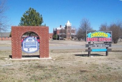
Location. 35° 28.71′ N, 95° 31.292′ W. Marker is in Checotah, Oklahoma, in McIntosh County. Marker is at the intersection of Broadway (Business U.S. 69) and North Avenue, on the right when traveling north on Broadway. Touch for map. Marker is at or near this postal address: 722 North Broadway, Checotah OK 74426, United States of America. Touch for directions.
Other nearby markers. At least 8 other markers are within walking distance of this marker. City Hall (approx. half a mile away); Veterans Memorial (approx. half a mile away); Methodist Episcopal Church, South (approx. 0.6 miles away); The Gentry Block (approx. 0.6 miles away); Kniseley and Long Building (approx. 0.6 miles away); Towry Brothers Building (approx. 0.6 miles away); 116 South Broadway (approx. 0.6 miles away); Paul Henry Carr (approx. one mile away). Touch for a list and map of all markers in Checotah.
Also see . . .
1. Jefferson Highway. Wikipedia entry (Submitted on January 11, 2024, by Larry Gertner of New York, New York.)
2. The Jefferson Highway Association. Website homepage (Submitted on April 22, 2014, by William Fischer, Jr. of Scranton, Pennsylvania.)
3. Jefferson Highway Association at Facebook. (Submitted on April 22, 2014, by William Fischer, Jr. of Scranton, Pennsylvania.)
Credits. This page was last revised on January 11, 2024. It was originally submitted on April 22, 2014, by William Fischer, Jr. of Scranton, Pennsylvania. This page has been viewed 576 times since then and 30 times this year. Photos: 1, 2. submitted on April 22, 2014, by William Fischer, Jr. of Scranton, Pennsylvania.

