Near Brownfield in Terry County, Texas — The American South (West South Central)
Gomez Cemetery
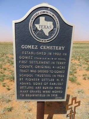
Photographed by Bill Kirchner, April 28, 2014
1. Gomez Cemetery Marker
Erected 1970 by State Historical Survey Committee. (Marker Number 2213.)
Topics. This historical marker is listed in these topic lists: Cemeteries & Burial Sites • Settlements & Settlers. A significant historical year for this entry is 1902.
Location. 33° 10.608′ N, 102° 21.648′ W. Marker is near Brownfield, Texas, in Terry County. It is on Farm to Market Road 345 0.3 miles south of U.S. 82/380, on the right when traveling south. Touch for map. Marker is in this post office area: Brownfield TX 79316, United States of America. Touch for directions.

Regionally, this marker is on Texas’ South Plains. It is also on the American Great Plains and specifically on the Southern Plains. Globally, it is in North America, a Gulf of Mexico state, the Western Hemisphere, the Western World, and the Anglosphere. Historically, it finds itself
this page online
Other nearby markers. At least 8 other markers are within 5 miles of this marker, measured as the crow flies: Gomez (approx. 0.7 miles away); Gomez Baptist Church (approx. 1.1 miles away); Brownfield Cemetery (approx. 4.1 miles away); Brownfield Municipal Power Plant (approx. 4½ miles away); City of Brownfield (approx. 4.6 miles away); In Honor of Terry Co. Veterans (approx. 4.6 miles away); "Flame of Freedom" (approx. 4.6 miles away); Colonel B. F. Terry / Terry's Texas Rangers (approx. 4.6 miles away). Touch for a list and map of all markers in Brownfield.
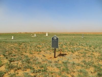
Photographed by Bill Kirchner, April 28, 2014
2. Gomez Cemetery Marker
Credits. This page was last revised on June 16, 2016. It was originally submitted on May 7, 2014, by Bill Kirchner of Tucson, Arizona. This page has been viewed 1,478 times since then and 43 times this year. Photos: 1, 2. submitted on May 7, 2014, by Bill Kirchner of Tucson, Arizona. • Bernard Fisher was the editor who published this page.
