Hope in Bonner County, Idaho — The American West (Mountains)
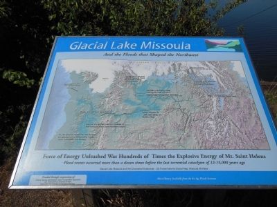
Glacial Lake Missoula
and the floods that shaped the Northwest
Force of energy unleashed was hundreds of times the explosive energy of Mt. Saint Helens
Flood events occurred more than a dozen times before the last torrential cataclysm of 12-15,000 years ago
Glacial Lake Missoula and the Channeled Scablands - US Forest Service Glacial Map, Missoula
Erected by Federal Highway Administration, Idaho Transportation Department, University of Idaho, Hope-Clark Fork Chamber of Commerce Members.
Topics. This historical marker is listed in these topic lists: Environment • Waterways & Vessels.
Location. 48° 15.421′ N, 116° 19.504′ W. Marker is in Hope, Idaho, in Bonner County. Marker is on State Highway 200, on the right when traveling south. Marker is near the center of an Idaho Route 200 pullout, overlooking the referenced lake, about one mile north of Hope, Idaho. Touch for map. Marker is in this post office area: Hope ID 83836, United States of America. Touch for directions.
Other nearby markers. At least 5 other markers are within 4 miles of this marker, measured as the crow flies. Glacial Ice Dam (here, next to this marker); Lake Pend Oreille (within shouting distance of this marker); Hope & East Hope (approx. 1.4 miles away); David Thompson & Finnan MacDonald (approx. 1˝ miles away); Kullyspell House (approx. 3.7 miles away).
More about this marker. This marker is beside the related Glacial Ice Dam marker.
Related marker. Click here for another marker that is related to this marker. To better understand the relationship, study each marker in the order shown.
Also see . . . Glacial Lake Missoula and the Ice Age Floods.
About 12,000 years ago, the valleys of western Montana lay beneath a lake nearly 2,000 feet deep. Glacial Lake Missoula formed as the Cordilleran Ice Sheet dammed the Clark Fork River just as it entered Idaho. The rising water behind the glacial dam weakened it until water burst through in a catastrophic flood that raced across Idaho, Oregon, and Washington toward the Pacific Ocean. (Submitted on May 7, 2014, by Cosmos Mariner of Cape Canaveral, Florida.)
Credits. This page was last revised on June 16, 2016. It was originally submitted on May 7, 2014, by Cosmos Mariner of Cape Canaveral, Florida. This page has been viewed 666 times since then and 25 times this year. Photo 1. submitted on May 7, 2014, by Cosmos Mariner of Cape Canaveral, Florida. • Bill Pfingsten was the editor who published this page.
