Parkersburg in Wood County, West Virginia — The American South (Appalachia)
Fort Boreman During the Civil War
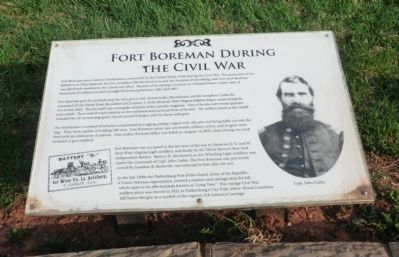
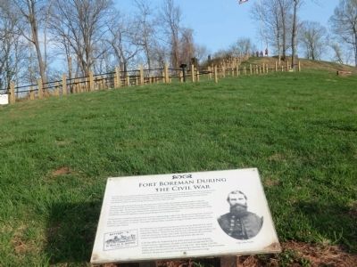
Fort Boreman gave the sentinels atop the hill a grand view of river traffic, the railroads, and the turnpikes. Under the command of Col. Daniel Frost, the soldiers of Company A of the Eleventh West Virginia Infantry began constructing the fort in June 1863. The fort itself was a triangular structure with a powder magazine. Also at the site were winter quarters and a stable. There were five gun stations on the northwest and northeast faces of the fort. The artillery pieces at the citadel included two 12-pound siege guns, one six-pound field gun, and two three-inch guns.
The fortification consisted of trenches constructed in a zigzag pattern ringed with rifle pits and firing holes cut into the logs. They were capable of holding 100 men. Fort Boreman never saw any hostile military action, and its guns were fired only on celebratory occasions. One soldier, Richard Miller, was killed on August 14, 1863, when during one such occasion, a gun misfired.
Fort Boreman was occupied in the last year of the war by Batteries D, G, and H, First West Virginia Light Artillery and finally by the Thirty-Second New York Independent Battery. Battery D, also known as the Wheeling Light Artillery, was under the command of Capt. John Carlin. The Fort Boreman site, previously owned by Jonathan B. Beckwith, was returned to him after the war.
In the late 1890s the Parkersburg Post of the Grand Army of the Republic, a Union veteran’s organization, erected a cannon and carriage atop the hill, which came to be affectionately known as “Long Tom.” This vintage Civil War artillery piece was moved in 1921 to Parkersburg’s City Park, where Wood Countians still honor the gun as a symbol of the region’s rich historical heritage.
(caption)
(right) Capt. John Carlin
Topics. This historical marker is listed in these topic lists: Forts and Castles • War, US Civil. A significant historical month for this entry is June 1863.
Location. This marker has been replaced by another marker nearby. It was located near 39° 15.725′ N, 81° 34.156′ W. Marker was in Parkersburg, West Virginia, in Wood County. Marker was on Fort Boreman Drive, one mile south of Robert Byrd Highway (Route 50). The marker is located in Fort Boreman Park. Touch for map. Marker was in this post office area: Parkersburg WV 26101, United States of America. Touch for directions.
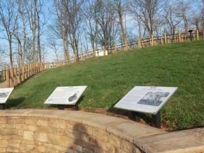
Other nearby markers. At least 8 other markers are within walking distance of this location. Parkersburg in 1861 (here, next to this marker); Welcome (a few steps from this marker); Fort Boreman During The Civil War (a few steps from this marker); Fort Boreman (a few steps from this marker); William L. “Mudwall” Jackson (within shouting distance of this marker); Fort Boreman Hill (within shouting distance of this marker); a different marker also named Fort Boreman (within shouting distance of this marker); Historic Parkersburg (West) Virginia (within shouting distance of this marker). Touch for a list and map of all markers in Parkersburg.
Related marker. Click here for another marker that is related to this marker. New Marker At This Location also titled "Fort Boreman During The Civil War".
Credits. This page was last revised on January 8, 2022. It was originally submitted on May 11, 2014, by Don Morfe of Baltimore, Maryland. This page has been viewed 476 times since then and 21 times this year. Photos: 1, 2, 3. submitted on May 11, 2014, by Don Morfe of Baltimore, Maryland. • Bernard Fisher was the editor who published this page.


