
Slaton in Lubbock County, Texas — The American South (West South Central)
Mercy Hospital
Photographed by Bill Kirchner, April 28, 2014
1. Mercy Hospital Marker
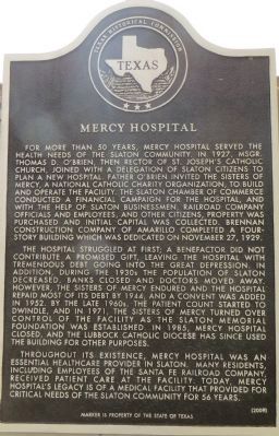
The hospital struggled at first; a benefactor did not contribute a promised gift, leaving the hospital with tremendous debt going into the great depression. In addition, during the 1930s the population of Slaton decreased, banks closed and doctors moved away. However, the Sisters of Mercy endured and the hospital repaid most of its debt by 1944. And a convent was added in 1952. By the late 1960s, the patient count started to dwindle, and in 1971, the Sisters of Mercy turned over control of the facility as the Slaton Memorial Foundation was established. In 1985, Mercy Hospital closed, and the Lubbock Catholic Diocese has since used the building for other purposes.
Throughout its existence, Mercy Hospital was an essential healthcare provider in Slaton. Many residents, including employees of the Santa Fe Railroad Company, received patient care at the facility. Today, Mercy Hospital's legacy is of a medical facility that provided for critical needs of the Slaton community for 56 years.
Erected 2009 by Texas Historical Commission. (Marker Number 15841.)
Topics. This historical marker is
this page online
Location. 33° 26.016′ N, 101° 39.339′ W. Marker is in Slaton, Texas, in Lubbock County. It is at the intersection of South 19th Street and West Division Street, on the right when traveling south on South 19th Street. Touch for map. Marker is at or near this postal address: 905 South 19th Street, Slaton TX 79364, United States of America. Touch for directions.

Regionally, this marker is on Texas’ South Plains. It is also on the American Great Plains, specifically on the Southern Plains, and specifically on the High Plains. Globally, it is in North America, a Gulf of Mexico state, the Western Hemisphere, the Western World, and the Anglosphere. Historically, it finds itself in what was once New Spain, the Comanchería, the Republic of Texas, and one of the Confederate States of America.
Other nearby markers. At least 8 other markers are within 7 miles of this marker, measured as the crow flies: Slaton Bakery (approx. 0.7 miles
Photographed by Bill Kirchner, April 28, 2014
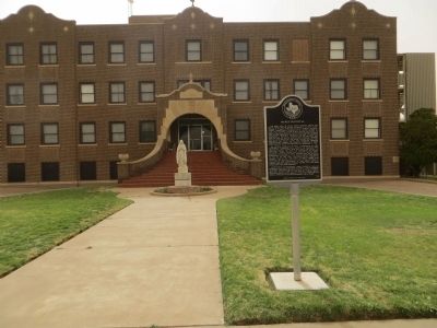
2. Mercy Hospital Marker
Photographed by Bill Kirchner, April 28, 2014
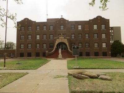
3. Mercy Hospital
Credits. This page was last revised on June 16, 2016. It was originally submitted on May 11, 2014, by Bill Kirchner of Tucson, Arizona. This page has been viewed 1,503 times since then and 119 times this year. Photos: 1, 2, 3. submitted on May 11, 2014, by Bill Kirchner of Tucson, Arizona. • Bernard Fisher was the editor who published this page.
