Ripley in Jackson County, West Virginia — The American South (Appalachia)
Partisan Raid
Ripley Post Office
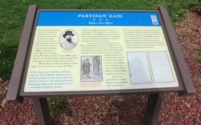
During the Civil War, both Union and Confederate supporters formed guerrilla bands. Each government denounced the other side’s partisans as bushwhackers or common thieves but gave those on their own side an official military designation as cover. When Capt. George Downs, of Calhoun County, formed the Moccasin Rangers, for example the Confederate government designated the unit the 19th Virginia Cavalry.
On December 19, 1861, the Rangers raided Ripley. Union Lt. Owen G. Chase, 9th (West) Virginia Infantry who was in town that day recruiting for Federal forces had disarmed the residents and locked the weapons in the jail. He probably suspected many of the townspeople of being Confederate sympathizers. Chase then marched his recruits west of town.
That evening, Pvt. Daniel Duskey and twelve other Rangers came into Ripley, took the arms from the jail, looted J.L. Armstrong’s store, and robbed local residents. When Postmaster John J. Wetzel refused to unlock the post office door, Duskey retorted that he had a key to unlock any door and kicked it down. The Rangers took everything of value, including all of Wetzel’s clothing except what he was wearing.
Duskey and Jacob Varner, another Ranger, were captured a few weeks later. They were convicted of robbery as civilians, since the government did not recognize the legitimacy of the Rangers, and were confined in Albany N.Y. On November 25, 1862, Confederates captured Union Capt. William Gramm and Lt. Isaac A. Wade near Charleston and then held them in Richmond. President Abraham Lincoln pardoned Duskey and Varner on June 13, 1863, so that they could be exchanged for the officers.
"As the Judge, Jury, Marshal, District Attorney and Post Master General join in asking a pardon in this case, I have concluded to grant it. The Attorney General will please make it out & send it to me." —President Abraham Lincoln.
Erected by West Virginia Civil War Trails.
Topics and series. This historical marker is listed in this topic list: War, US Civil. In addition, it is included in the Former U.S. Presidents: #16 Abraham Lincoln, and the West Virginia Civil War Trails series lists. A significant historical month for this entry is June 1848.
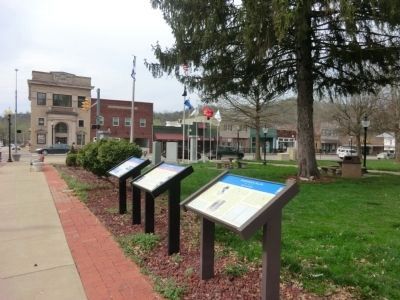
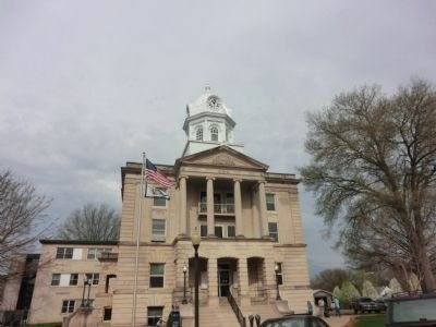
Location. 38° 49.152′ N, 81° 42.715′ W. Marker is in Ripley, West Virginia, in Jackson County. Marker is at the intersection of Court Street North and West Main Street (U.S. 33), on the left when traveling north on Court Street North. The marker is located on the grounds of the Jackson County Courthouse. Touch for map. Marker is in this post office area: Ripley WV 25271, United States of America. Touch for directions.
Other nearby markers. At least 8 other markers are within walking distance of this marker. Ripley (here, next to this marker); a different marker also named Ripley (here, next to this marker); Civil War Memorial (a few steps from this marker); Jackson County Veterans Memorial Park (a few steps from this marker); Pfost-Greene Murders / Last Public Execution (within shouting distance of this marker); Brother Harry Ripley (within shouting distance of this marker); Raid on Ripley (about 400 feet away, measured in a direct line); a different marker also named Ripley (about 500 feet away). Touch for a list and map of all markers in Ripley.
Credits. This page was last revised on August 2, 2021. It was originally submitted on May 12, 2014, by Don Morfe of Baltimore, Maryland. This page has been viewed 664 times since then and 32 times this year. Photos: 1, 2, 3. submitted on May 12, 2014, by Don Morfe of Baltimore, Maryland. • Bernard Fisher was the editor who published this page.


