
Whitley City in McCreary County, Kentucky — The American South (East South Central)
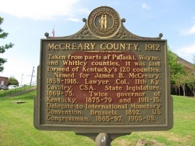
McCreary County, 1912
Photographed by Lee Hattabaugh, July 25, 2012
1. McCreary County, 1912 Marker
Taken from parts of Pulaski, Wayne, and Whitley counties, it was last formed of Kentucky's 120 counties.
Named for James B. McCreary, 1838-1918. Lawyer, Col., 11th Ky. Cavalry, CSA. State legislature, 1869-75. Twice governor of Kentucky, 1875-79 and 1911-15. Delegate to International Monetary Convention, Brussels, 1892. US Congressman, 1885-97, 1903-09.
Erected 1969 by Kentucky Historical Society/Kentucky Department of Highways. (Marker Number 1243.)
Topics and series. This historical marker is listed in these topic lists: Government & Politics • Patriots & Patriotism • Political Subdivisions • War, US Civil. In addition, it is included in the Kentucky Historical Society series list. A significant historical year for this entry is 1892.
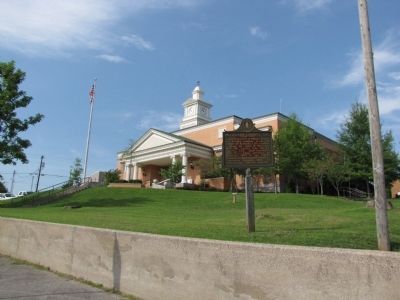
Location. 36° 43.568′ N, 84° 28.201′ W. Marker is in Whitley City, Kentucky, in McCreary County. It is at the intersection of Main Street (Kentucky Route 1651) and Court Street/Geary Avenue, on the right when traveling south on Main Street. Marker is located on the grounds of the McCreary County courthouse, in the northeast corner. Touch for map. Marker is in this
this page online

Regionally, this marker is in Eastern Kentucky, in the Lake Cumberland Region, and in the Cumberland Plateau. It is also in the American South, specifically in the Upper South, in Appalachia, and specifically in Southern Appalachia. Globally, it is in North America, the Western Hemisphere, the Western World, and the Anglosphere. Historically, it finds itself in what was once the territory of the Mississippian Culture and also the Antebellum South.
Other nearby markers. At least 8 other markers are within 11 miles of this marker, measured as the crow flies: First Kentucky Oil Well / Martin Beaty (Beatty) (within shouting distance of this marker); Historic Stearns Kentucky (approx. 1.9 miles away); Sandstone Tree Stump (approx. 1.9 miles away); Stearns Coal & Lumber Company (approx. 1.9 miles away); Princess Cornblossom (approx. 1.9 miles away); Edward "Eddie" Ward (approx. 4.7 miles away); Tennessee / Kentucky (approx. 9.2 miles away in Tennessee); Big Bend Loop (approx. 10.3 miles away).
Another marker is no longer nearby. 4-H Craft Center
Photographed by Lee Hattabaugh, July 25, 2012
2. McCreary County, 1912 Marker
Photographed by Lee Hattabaugh, July 25, 2012
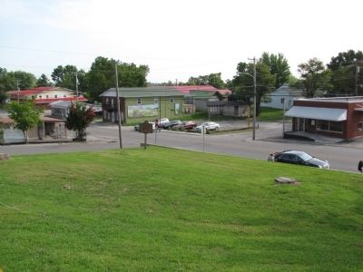
3. McCreary County, 1912 Marker
Taken from the courthouse steps, looking northeast toward Main St/Court St intersection
Credits. This page was last revised on September 21, 2020. It was originally submitted on May 15, 2014, by Lee Hattabaugh of Capshaw, Alabama. This page has been viewed 856 times since then and 58 times this year. Photos: 1, 2, 3. submitted on May 15, 2014, by Lee Hattabaugh of Capshaw, Alabama. • Bernard Fisher was the editor who published this page.
