Mount Sterling in Montgomery County, Kentucky — The American South (East South Central)
Battle of Mt. Sterling
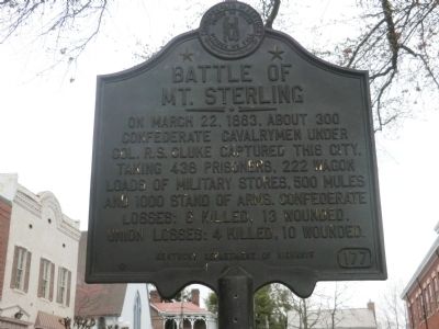
Photographed by Don Morfe, April 15, 2014
1. Battle of Mt. Sterling Marker
Erected by Kentucky Department of Highways. (Marker Number 177.)
Topics and series. This historical marker is listed in this topic list: War, US Civil. In addition, it is included in the Kentucky Historical Society series list. A significant historical month for this entry is March 1887.
Location. 38° 3.414′ N, 83° 56.586′ W. Marker is in Mount Sterling, Kentucky, in Montgomery County. It is on Broadway Street. Touch for map. Marker is in this post office area: Mount Sterling KY 40353, United States of America. Touch for directions.

Regionally, this marker is in Kentucky’s Outer Bluegrass. It is also in the American South and specifically in the Upper South. Globally, it is in North America, the Western Hemisphere, the Western World, and the Anglosphere. Historically, it finds itself in what was once the territory of the Mississippian Culture and also the
this page online
Other nearby markers. At least 8 other markers are within walking distance of this marker: Montgomery County Veterans Memorial (a few steps from this marker); Montgomery County Korean War Memorial (within shouting distance of this marker); Montgomery County Kentucky World War I Memorial (within shouting distance of this marker); Montgomery County World War II Memorial (within shouting distance of this marker); Montgomery County. 1797 (within shouting distance of this marker); Courthouse Burned (within shouting distance of this marker); Montgomery County Kentucky Vietnam Casualties (within shouting distance of this marker); Mt. Sterling, Kentucky (about 300 feet away, measured in a direct line). Touch for a list and map of all markers in Mount Sterling.
Related markers. Click here for a list of markers that are related to this marker.
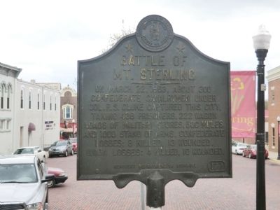
Photographed by Don Morfe, April 15, 2014
2. Battle of Mt. Sterling Marker
Credits. This page was last revised on June 16, 2016. It was originally submitted on May 19, 2014, by Don Morfe of Baltimore, Maryland. This page has been viewed 2,035 times since then and 76 times this year. Photos: 1, 2. submitted on May 19, 2014, by Don Morfe of Baltimore, Maryland. • Bill Pfingsten was the editor who published this page.
