Crestview in Okaloosa County, Florida — The American South (South Atlantic)
Old Bethel Cemetery
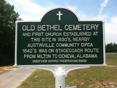
Photographed by K. McNair, May 24, 2014
1. Old Bethel Cemetery Marker
Erected 2013 by the Crestview Historic Preservation Board.
Topics. This historical marker is listed in these topic lists: Cemeteries & Burial Sites • Religion & Religious Structures.
Location. 30° 47.541′ N, 86° 36.163′ W. Marker is in Crestview, Florida, in Okaloosa County. It is at the intersection of Old Bethel Road (County Road 188) and Sioux Circle, on the left when traveling north on Old Bethel Road. Touch for map. Marker is at or near this postal address: 5783 Old Bethel Road, Crestview FL 32536, United States of America. Touch for directions.

Regionally, this marker is on the Florida Panhandle.
this page online
Other nearby markers. At least 8 other markers are within 5 miles of this marker, measured as the crow flies: Concord Lodge No. 50 F & AM (approx. 2.8 miles away); Okaloosa County (approx. 2.8 miles away); a different marker also named Okaloosa County (approx. 2.8 miles away); Okaloosa County Veterans Memorial (approx. 2.9 miles away); Bush House (approx. 3.2 miles away); Crestview Lodge #364 F&AM PHA (approx. 3.4 miles away);
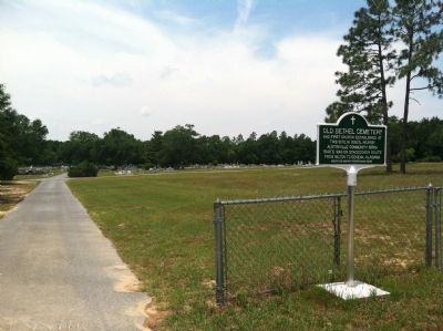
Photographed by K. McNair, May 24, 2014
2. Old Bethel Cemetery
Another marker is no longer nearby. Confederate Park (was approx. 4.4 miles away but has been permanently removed).
Credits. This page was last revised on October 28, 2020. It was originally submitted on May 25, 2014, by Mark Hilton of Montgomery, Alabama. This page has been viewed 1,589 times since then and 118 times this year. Photos: 1, 2. submitted on May 25, 2014, by Mark Hilton of Montgomery, Alabama. • Bernard Fisher was the editor who published this page.
