Marker Logo HMdb.org THE HISTORICAL
MARKER DATABASE
“Bite-Size Bits of Local, National, and Global History”
Near Brewersville in Jennings County, Indiana — The American Midwest (Great Lakes)
 

Kellar Grist Mill


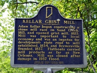
Kellar Grist Mill Marker image. Click for full size.
Photographed By Duane Hall, May 22, 2014
1. Kellar Grist Mill Marker
Inscription. Adam Kellar began constructing a stone mill race on Sand Creek, 1813, and opened grist mill, 1823. Mill was important to local economy and was an impetus for development: state road to mill established, 1834, and Brewersville founded, 1837. Flatboats carried mill products as far as New Orleans. Mill was closed after damage in 1937 flood.
 
Erected 1997 by Indiana Historical Bureau and Jennings County Historical Society. (Marker Number 40.1997.2.)
 
Topics and series. This historical marker is listed in these topic lists: Industry & CommerceRoads & VehiclesSettlements & Settlers. In addition, it is included in the Indiana Historical Bureau Markers series list. A significant historical year for this entry is 1813.
 
Location. 39° 4.669′ N, 85° 36.668′ W. Marker is near Brewersville, Indiana, in Jennings County. Marker is on N. Base Road, 0.4 miles south of Washington Street. Touch for map. Marker is in this post office area: North Vernon IN 47265, United States of America. Touch for directions.
 
Other nearby markers. At least 8 other markers are within 7 miles of this marker, measured as the crow flies. Grouseland Treaty Line (approx. 4.8 miles away); Pat O’Connor (approx. 4.8 miles away); Walnut Grove One-room School 1913 (approx. 6.1 miles away); Muscatatuck Park
Paid Advertisement
Click on the ad for more information.
Please report objectionable advertising to the Editor.
Click or scan to see
this page online
(approx. 6.1 miles away); Hannah Milhous Nixon (approx. 6.3 miles away); Morgan's Raid (approx. 6.4 miles away); Vernon Historic District (approx. 6.4 miles away); New Survey Markers Set (approx. 6.4 miles away).
 
Also see . . .  Kellar Mill at Brewersville, Indiana. Photograph of mill dated June 9, 1925 from the Indiana Historical Society. (Submitted on May 25, 2014.) 
 
Kellar Grist Mill Marker image. Click for full size.
Photographed By Duane Hall, May 22, 2014
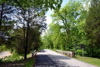
2. Kellar Grist Mill Marker
View to south along N. Base Road. Sand Creek is located on both the east side and the west side of the road.
Kellar Mill Race image. Click for full size.
Photographed By Duane Hall, May 22, 2014
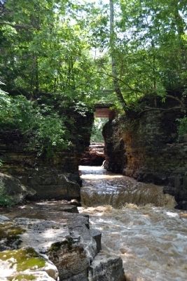
3. Kellar Mill Race
The Kellar mill race was chiseled out of the bedrock in a long bend of Sand Creek. The marker is located on the left side of the bridge crossing the mill race.
Kellar Mill Race Flowing into Sand Creek image. Click for full size.
Photographed By Duane Hall, May 22, 2014
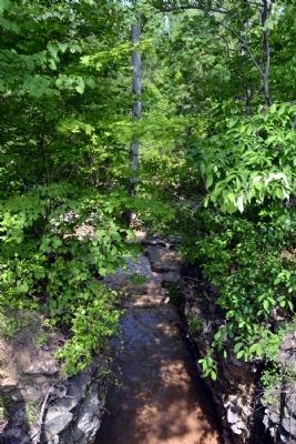
4. Kellar Mill Race Flowing into Sand Creek
View to west from N. Base Road bridge
 
 
Credits. This page was last revised on June 16, 2016. It was originally submitted on May 25, 2014, by Duane Hall of Abilene, Texas. This page has been viewed 890 times since then and 30 times this year. Photos:   1, 2, 3, 4. submitted on May 25, 2014, by Duane Hall of Abilene, Texas.
Share this page.  
Share on Tumblr
m=73975

CeraNet Cloud Computing sponsors the Historical Marker Database.
This website earns income from purchases you make after using our links to Amazon.com. We appreciate your support.
Paid Advertisement
Apr. 25, 2024