Near Falls Church in Fairfax County, Virginia — The American South (Mid-Atlantic)
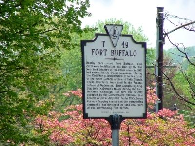
Fort Buffalo
Photographed by J. J. Prats, April 26, 2008
1. Fort Buffalo Marker
Erected 2000 by Department of Historic Resources. (Marker Number T-49.)
Topics and series. This historical marker is listed in this topic list: War, US Civil. In addition, it is included in the Defenses of Washington series list. A significant historical month for this entry is July 1861.
Location. 38° 52.2′ N, 77° 9.433′ W. Marker is near Falls Church, Virginia, in Fairfax County. It is on Sleepy Hollow Road (County Route 613) south of Leesburg Pike (Virginia Route 7), on the left when
this page online

Regionally, this marker is in the Washington Metropolitan Area and in Northern Virginia. It is also in the American South, specifically in the Upper South, in the Mid-Atlantic, and on the Eastern Seaboard. Globally, it is in the North Atlantic Region, North America, the Western Hemisphere, the Western World, and the Anglosphere. Historically, it finds itself in what was once the territory of the Mississippian Culture, one of the original Thirteen Colonies, one of the Confederate States of America, and the Antebellum South.
Other nearby markers. At least 8 other markers are within walking distance of this marker: Vietnamese Immigrants in Northern Virginia
Photographed by J. J. Prats, April 26, 2008
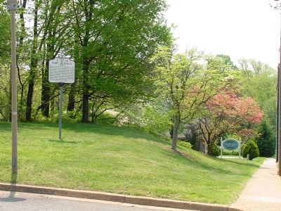
2. Fort Buffalo Marker
Also see . . .
1. Where Was Fort Buffalo?. Monograph by Mark Doehnert. “Apparently construction started on the October, 4 1861 and was completed on October 24 and christened ‘Fort Buffalo.’ It was reported the Union Generals McClellan and McDowell and Brigadier General Wadsworth visited the Fort.” (Submitted on January 16, 2009.)
2. 1st Wisconsin Heavy Artillery at Fort Buffalo. Company K of the Wisconsin Second Infantry became Company A of the First Wisconsin Heavy Artillery after the retreat from 1st Manassas. The regiment was posted at Fort Buffalo in 1862 after the retreat from 2nd Manassas and repulsed a Confederate attack. (Submitted on April 1, 2009, by Rob Aronson of Alexandria, Virginia.)
Photographed by J. J. Prats, April 26, 2008
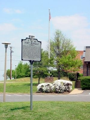
3. Fort Buffalo Marker
This view is towards Seven Corners. Firehouse is on the right.
Credits. This page was last revised on July 28, 2025. It was originally submitted on April 27, 2008, by J. J. Prats of Powell, Ohio. This page has been viewed 9,620 times since then and 324 times this year. Photos: 1, 2, 3. submitted on April 27, 2008, by J. J. Prats of Powell, Ohio. • Craig Swain was the editor who published this page.
