Cumberland in Buckingham County, Virginia — The American South (Mid-Atlantic)
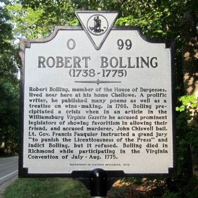
Robert Bolling
(1738-1775)
Erected 2012 by Department of Historic Resources. (Marker Number O-99.)
Topics and series. This historical marker is listed in these topic lists: Colonial Era • Government & Politics. In addition, it is included in the Virginia Department of Historic Resources (DHR) series list. A significant historical year for this entry is 1766.
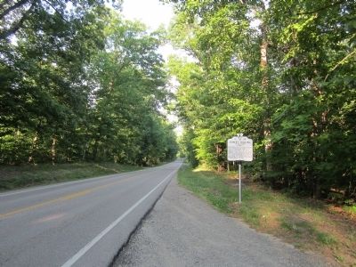
Location. 37° 29.998′ N, 78° 24.179′ W. Marker is in Cumberland, Virginia, in Buckingham County. Marker is on East James Anderson Highway (U.S. 60) 0.2 miles east of Scotts Bottom Road (Virginia Route 632), on the right when traveling east. Touch for map. Marker is in this post office area: Cumberland VA 23040, United States of America. Touch for directions.
Other nearby markers. At least 8 other markers are within 5 miles of this marker, measured as the crow flies. Buckingham County / Cumberland County (approx. 2.9 miles away); Chief Cornerstone Baptist Church (approx. 4 miles away); Civilian Conservation Corps Camp P-56, Company 1367 (approx. 4.1 miles away); Buckingham Training School (approx. 4.2 miles away); Ellis Acres Park (approx. 4.2 miles away); Gold Mines (approx. 4.8 miles away); Millbrook (approx. 4.8 miles away); a different marker also named Buckingham Training School (approx. 4.9 miles away).
Credits. This page was last revised on June 16, 2016. It was originally submitted on May 26, 2014, by Bernard Fisher of Richmond, Virginia. This page has been viewed 821 times since then and 38 times this year. Photos: 1, 2. submitted on May 26, 2014, by Bernard Fisher of Richmond, Virginia.

