Near Holton in Ripley County, Indiana — The American Midwest (Great Lakes)
O'Brien Corner
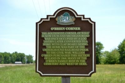
Photographed by Duane Hall, May 22, 2014
1. O'Brien Corner Marker
Erected by Ripley County Historical Society.
Topics. This historical marker is listed in these topic lists: Cemeteries & Burial Sites • Settlements & Settlers. A significant historical year for this entry is 1864.
Location. 39° 4.499′ N, 85° 20.923′ W. Marker is near Holton, Indiana, in Ripley County. It is at the intersection of Michigan Road and U.S. 50, on the right when traveling north on Michigan Road. Touch for map. Marker is in this post office area: Holton IN 47023, United States of America. Touch for directions.

Regionally, this marker is in Southern Indiana. It is also in the American Midwest and in the Corn Belt. Globally, it is in North America, the Western Hemisphere, the Western World, and the Anglosphere. Historically, it finds itself in what was once the
this page online
Other nearby markers. At least 8 other markers are within 5 miles of this marker, measured as the crow flies: Michigan Road (a few steps from this marker); Bilby Loop (approx. 4.3 miles away); Crusher Lane (approx. 4.3 miles away); The Bilby Tower (approx. 4.3 miles away); Bilby Steel Tower (approx. 4.6 miles away); Willson House (approx. 4.7 miles away); Ohio and Mississippi Railroad (approx. 4.8 miles away); William Forsyth, Artist (approx. 4.9 miles away).
More about this marker. The marker is located at the southeast corner of the intersection of Michigan Road and US 50. O'Brien Corner is at the southwest corner of the intersection across Michigan Road from the marker.
Additional commentary.
1. O'Brien Cemetery
The O'Brien Cemetery is located on the south side of US 50 approximately 800 feet west of the marker and Michigan Road.
— Submitted May 27, 2014, by Duane Hall of Abilene, Texas.
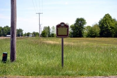
Photographed by Duane Hall, May 22, 2014
2. O'Brien Corner Marker
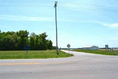
Photographed by Duane Hall, May 22, 2014
3. O'Brien Corner
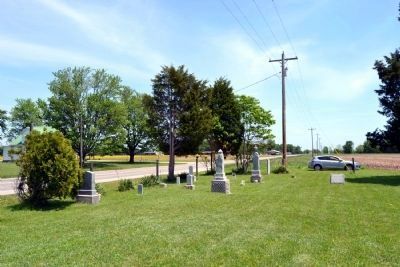
Photographed by Duane Hall, May 22, 2014
4. O'Brien Cemetery
which is 800 feet from the cemetery
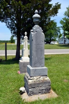
Photographed by Duane Hall, May 22, 2014
5. Burial Headstone for William O'Brien
Credits. This page was last revised on June 16, 2016. It was originally submitted on May 27, 2014, by Duane Hall of Abilene, Texas. This page has been viewed 581 times since then and 23 times this year. Photos: 1, 2, 3, 4, 5. submitted on May 27, 2014, by Duane Hall of Abilene, Texas.
