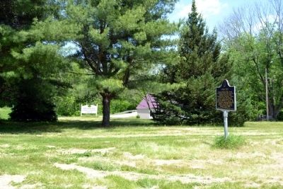
Near Madison in Jefferson County, Indiana — The American Midwest (Great Lakes)
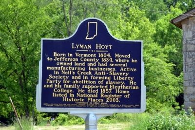
Lyman Hoyt
(Side One)
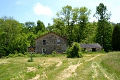
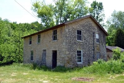
Born in Vermont 1804. Moved to Jefferson County 1834, where he owned land and had several manufacturing businesses. Active in Neil’s Creek Anti-Slavery Society and in forming Liberty Party for abolition of slavery. He and his family supported Eleutherian College. He died 1857. Home listed in National Register of Historic Places 2003.
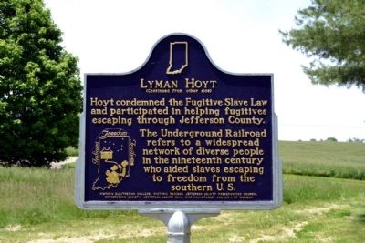
(Side Two)
Hoyt condemned the Fugitive Slave Law and participated in helping fugitives escaping through Jefferson County. The Underground Railroad refers to a widespread network of diverse people in the nineteenths century who aided slaves escaping to freedom from the southern U.S.
Erected 2004 by Indiana Historical Bureau, Division of Historic Preservation & Archaeology, IDNR, African American Landmarks Committee of Historic Landmarks Foundation of Indiana, Inc. (Marker Number 39.2004.2.)
Topics and series. This historical marker is listed in this topic list: Abolition & Underground RR. In addition, it is included in the Indiana Historical Bureau Markers series list. A significant historical year for this entry is 1804.
Location. 38° 49.945′ N, 85° 31.223′ W. Marker is near Madison, Indiana, in Jefferson County. Marker can be reached from the intersection of State Road 250 and Boyd Road (County Road N700W), on the right when traveling east. Touch for map. Marker is at or near this postal address: 7147 W State Route 250, Madison IN 47250, United States of America. Touch for directions.
Other nearby markers. At least 8 other markers are within 7 miles of this marker, measured as the crow flies. Eleutherian College (approx. 0.2 miles away); John H. and Sarah Tibbets (approx. 0.3 miles away); Morgan's Troops Camped Here (approx. 3.9 miles away); Morgan's Raid (approx. 3.9 miles away); Dupont: Fourth Night in Indiana (approx. 3.9 miles away); Gen. John Morgan's Troops (approx. 4.4 miles away); Morgan Finds a Hoosier Oasis (approx. 6.2 miles away); Harvey Washington Wiley, M.D. (approx. 6.7 miles away). Touch for a list and map of all markers in Madison.
More about this marker. The marker is part of the Indiana Freedom Trails, a State historical marker program dedicated especially to the interpretation of the Underground Railroad in Indiana. The program has three purposes: “to document and interpret Underground Railroad history in Indiana; to bring attention to that history with a visual reminder of the importance of those people, places, and events which constitute the history and context of the Underground Railroad in Indiana; and to assist the many individuals and groups – especially Indiana Freedom Trails – working to preserve the Underground Railroad history of Indiana through a heightened awareness of their existence and needs.”
Also see . . .
1. IHB Annotations. The Indiana Historical Bureau provides annotations for the text of the marker on their website. (Submitted on May 27, 2014.)
2. The Story of the Lyman Hoyt House. From the Indiana Department of Natural Resources. (Submitted on May 27, 2014.)
3. Lyman and Asenauth Hoyt House. From the National Park Service website. (Submitted on May 27, 2014.)
Credits. This page was last revised on June 16, 2016. It was originally submitted on May 27, 2014, by Duane Hall of Abilene, Texas. This page has been viewed 706 times since then and 23 times this year. Photos: 1, 2, 3, 4, 5. submitted on May 27, 2014, by Duane Hall of Abilene, Texas.
