Near Institute in Door County, Wisconsin — The American Midwest (Great Lakes)
Scow Schooner Ocean Wave
Historic Shipwreck
| — | Wisconsin's Maritime Trails | — |
Photographed by K. Linzmeier, June 8, 2014
1. Scow Schooner Ocean Wave Marker
Type: Wooden schooner, two-masted
Built: 1860, Robert Chambers, Harsen's Island, Mich.
Sank: September 23, 1869
Length: 73' Beam 20'
Cargo: Stone
Depth of Wreckage: 110'
Listed on the National Register of Historic Places
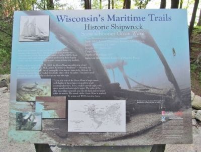
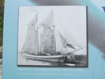
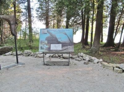
Four miles southeast of here, in 110 feet of water, lie the remains of the Ocean Wave. The two-masted wooden ship was a scow schooner, a boxy, flat-bottomed vessel of the late 1800s. Scow schooners could enter shallower harbors more easily than shapely vessels, and they connected small frontier towns to large city markets.
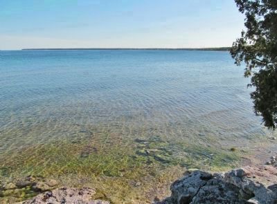
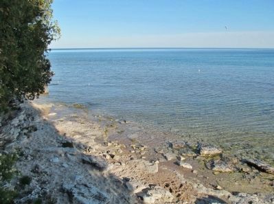
In the early morning of Sept. 23, 1869, the Ocean Wave was delivering a load of limestone to White Lake, Mich., when she struck a 'deadhead' – a floating log or timber. She sank quickly, barely leaving the crew time to launch the lifeboat. In his haste, Captain Fletcher Hackett reportedly left $160 in his cabin. The crew rowed through the night and finally reached shore near this sign.
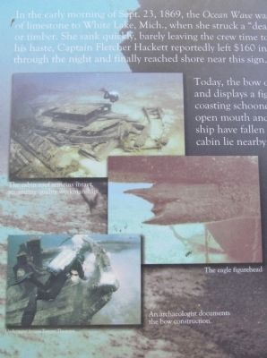
Today, the bow of the Ocean Wave is largely intact and displays a figurehead, unusual for small coasting schooners. It is a crudely carved eagle, with open mouth and extended
this page online
logos of: Wisconsin Historical Society, Sea Grant · University of Wisconsin, NOAA, Wisconsin Coastal Management Program
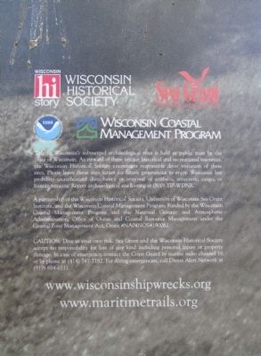
Title to Wisconsin's submerged archaeological sites is held in public trust by the State of Wisconsin. As steward of these unique historical and recreational resources, the Wisconsin Historical Society encourages responsible diver visitation of these sites. Please leave these sites intact for future generations to enjoy. Wisconsin law prohibits unauthorized disturbance or removal of artifacts, structure, cargo, or human remains. Report archaeological site looting at (800) TIP-WDNR.
A partnership of the Wisconsin Historical Society, University of Wisconsin Sea Grant Institute, and the Wisconsin Coastal Management Program. Funded by the Wisconsin Coastal Management Program and the National Oceanic and Atmospheric Administration, Office of Ocean and Coastal Resource Management under the Coastal Zone Management Act, Grant #NA04NOS4190062.
CAUTION: Dive at your own risk. Sea Grant and the Wisconsin Historical Society accept no responsibility for loss of any kind including personal injury or property damage. In case of emergency, contact the Coast Guard by marine radio channel 16 or by phone at (414) 747-7182. For diving emergencies, call Divers Alert Network at (919) 684-8111.
www.maritimetrails.org
Erected by the
Photographed by K. Linzmeier, June 8, 2014
2. Close-up of Photo
Topics and series. This historical marker is listed in this topic list: Waterways & Vessels. In addition, it is included in the Lost at Sea, and the Wisconsin’s Maritime Trails series lists. A significant historical month for this entry is September 1855.
Location. 44° 55.586′ N, 87° 10.922′ W. Marker is near Institute, Wisconsin, in Door County. It can be reached from Clark Lake Road (County Road WD) 3.8 miles east of State Highway 57, on the right when traveling east. Marker is in Whitefish Dunes State Park. Fee area; a vehicle admission sticker is required. Touch for map. Marker is at or near this postal address: 3275 Clark Lake Road, Sturgeon Bay WI 54235, United States of America. Touch for directions.

Regionally, this marker is on the Door Peninsula. It is also in the American Midwest and in the Corn Belt. Globally, it is in North America, on the Great Lakes, in the Western Hemisphere, in the Western World, and in the Anglosphere. Historically, it finds itself in what was once the territory of the Mississippian Culture and also the Northwest Territory.
Photographed by K. Linzmeier, June 8, 2014
3. Close-up of Photos
Other nearby markers. At least 8 other markers are within walking distance of this marker: Sailing Straight and Strong (here, next to this marker); Ship's Skeleton (here, next to this marker); Anchors Aweigh! (here, next to this marker); Combined in Strength (here, next to this marker); Keep the Boat Afloat (here, next to this marker); Why Do Ships Wreck? (a few steps from this marker); From Wind to Steam (a few steps from this marker); Shipwrecks Tell Stories (within shouting distance of this marker).
More about this marker. captions:
• Magdalena, a scow schooner similar to the Ocean Wave Historical Collections of the Great Lakes, Bowling Green State University
• The cabin roof remains intact, suggesting quality workmanship.
• The eagle figurehead
• An archaeologist documents the bow construction.
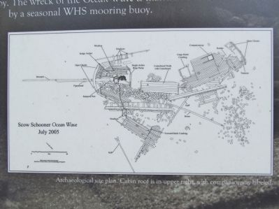
• Archaeological site plan. Cabin roof is in upper right, with companionway labeled.
• Background image: Looking aft through the bow, the windlass and anchor chain are visible.
Also see . . . Wisconsin Maritime Trails. (Submitted on June 10, 2014.)
Photographed by K. Linzmeier, June 8, 2014
4. Close-up of Archaeological Site Plan
Photographed by K. Linzmeier, June 8, 2014
5. Close-up of Attributions and Looting Notice
Photographed by K. Linzmeier, June 8, 2014
6. Scow Schooner Ocean Wave Marker
Photographed by K. Linzmeier, June 8, 2014
7. Whitefish Bay by Marker
Photographed by K. Linzmeier, June 8, 2014
8. Lake Michigan by Marker
Photographed by K. Linzmeier, June 8, 2014
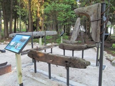
9. Displays by Marker
Photographed by K. Linzmeier, June 8, 2014
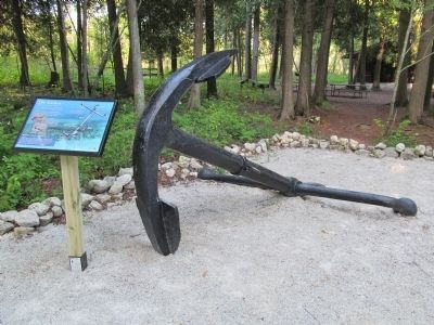
10. Anchor by Marker
Credits. This page was last revised on October 14, 2021. It was originally submitted on June 10, 2014, by Keith L of Wisconsin Rapids, Wisconsin. This page has been viewed 967 times since then and 32 times this year. Photos: 1, 2, 3, 4, 5, 6, 7, 8, 9, 10. submitted on June 10, 2014, by Keith L of Wisconsin Rapids, Wisconsin.
