Jones/Buena Vista in Nashville in Davidson County, Tennessee — The American South (East South Central)
The Temple Cemetery
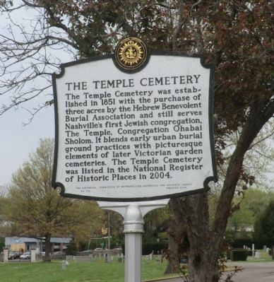
Photographed by Don Morfe, April 18, 2014
1. The Temple Cemetery Marker
Erected 2004 by The Historical Commission of Metropolitan Nashville and Davidson County. (Marker Number 119.)
Topics and series. This historical marker is listed in these topic lists: Cemeteries & Burial Sites • Religion & Religious Structures. In addition, it is included in the Tennessee, The Historical Commission of Metropolitan Nashville and Davidson County series list. A significant historical year for this entry is 1851.
Location. 36° 11.016′ N, 86° 48.618′ W. Marker is in Nashville, Tennessee, in Davidson County. It is in Jones/Buena Vista. It is on Clay Street. Touch for map. Marker is in this post office area: Nashville TN 37208, United States of America. Touch for directions.

Regionally, this marker
this page online
Other nearby markers. At least 8 other markers are within walking distance of this marker: Engine Company No. 11 (approx. 0.3 miles away); North Nashville High School (approx. 0.3 miles away); Buena Vista Park (approx. half a mile away); Jones School / School Desegregation in Nashville “Nashville Plan” Schools (approx. half a mile away); Robert Churchwell, Sr. (approx. half a mile away); Saint Cecilia Academy (approx. 0.6 miles away); Zephaniah Alexander Looby (approx. 0.7 miles away); Samuel Watkins (approx. ¾ mile away). Touch for a list and map of all markers in Nashville.
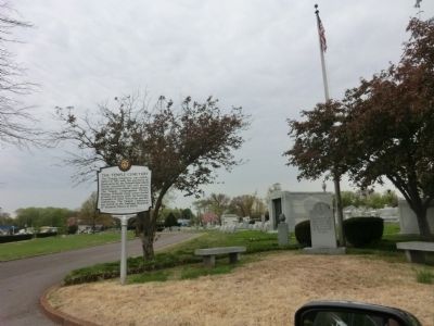
Photographed by Don Morfe, April 18, 2014
2. The Temple Cemetery Marker
Credits. This page was last revised on February 7, 2023. It was originally submitted on June 11, 2014, by Don Morfe of Baltimore, Maryland. This page has been viewed 842 times since then and 34 times this year. Photos: 1, 2. submitted on June 11, 2014, by Don Morfe of Baltimore, Maryland. • Bill Pfingsten was the editor who published this page.
