Portage in Columbia County, Wisconsin — The American Midwest (Great Lakes)
Pierre Pauquette Ferry

Photographed by Paul Fehrenbach, June 9, 2014
1. Pierre Pauquette Ferry Marker
Erected 1928 by Wau-Bun Chapter, D.A.R.
Topics and series. This historical marker is listed in these topic lists: Bridges & Viaducts • Settlements & Settlers • Waterways & Vessels. In addition, it is included in the Daughters of the American Revolution (DAR) series list. A significant historical year for this entry is 1828.
Location. 43° 32.258′ N, 89° 28.444′ W. Marker is in Portage, Wisconsin, in Columbia County. It is on Cook Street (State Highway 33), on the right when traveling south. Marker is located in Pauquette Park at the foot of the Wisconsin River bridge. Touch for map. Marker is in this post office area: Portage WI 53901, United States of America. Touch for directions.

Regionally, this marker is in Greater Madison. It is also in the American Midwest and in the Corn Belt. Globally, it is in North America, the Western Hemisphere, the Western World, and the Anglosphere. Historically, it
this page online
Other nearby markers. At least 8 other markers are within 3 miles of this marker, measured as the crow flies: Trinity United Church of Christ (approx. 0.4 miles away); Society Hill Historic District (approx. 0.6 miles away); Frederick Jackson Turner (approx. 0.6 miles away); Zona Gale (approx. 0.6 miles away); Jacques Marquette and Louis Joliet (approx. 1.3 miles away); Ketchum’s Point (approx. 1.4 miles away); Marquette (approx. 2.3 miles away); Fort Winnebago (approx. 2.3 miles away). Touch for a list and map of all markers in Portage.
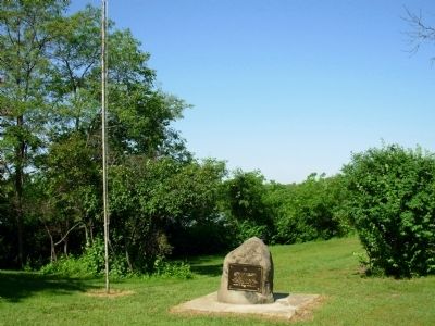
Photographed by Paul Fehrenbach, June 9, 2014
2. Pierre Pauquette Ferry Marker
Wisconsin River is behind the marker.
Credits. This page was last revised on June 16, 2016. It was originally submitted on June 12, 2014, by Paul Fehrenbach of Richfield, Wisconsin. This page has been viewed 1,217 times since then and 49 times this year. Photos: 1, 2. submitted on June 12, 2014, by Paul Fehrenbach of Richfield, Wisconsin. • Bill Pfingsten was the editor who published this page.
