Near Ehrhardt in Bamberg County, South Carolina — The American South (South Atlantic)
Battle of Rivers' Bridge
Feb. 2-3, 1865
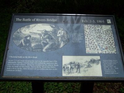
On Feb.2, Union troops moved up the road on the opposite bank of the Salkehatchie, fighting a running battle with the Confederate cavalrymen who tried to slow their advance. Among the casualties was Pvt. John B. Woods of the 3rd South Carolina Cavalry. Shot in the leg, Woods later bled to death at Rivers Bridge, where his unit took up position near here on the Confederate left flank.
Erected by South Carolina State Park Service.
Topics. This historical marker is listed in this topic list: War, US Civil.
Location. 33° 3.22′ N, 81° 6.11′ W. Marker is near Ehrhardt, South Carolina, in Bamberg County. Marker can be reached from SC-S-5-8, on the right when traveling south. Located in the Rivers Bridge State Park, a mile south of SC-S-5-31. Touch for map. Marker is in this post office area: Ehrhardt SC 29081, United States of America. Touch for directions.
Other nearby markers. At least 8 other markers are within walking distance of this marker. A different marker also named Battle of Rivers' Bridge (within shouting distance of this marker); a different marker also named Battle of Rivers' Bridge (within shouting distance of this marker); a different marker also named Battle of Rivers' Bridge (within shouting distance of this marker); a different marker also named Battle of Rivers' Bridge (about 600 feet away, measured in a direct line); a different marker also named Battle of Rivers' Bridge (about 600 feet away); a different marker also named Battle of Rivers' Bridge (about 700 feet away); a different marker also named Battle of Rivers' Bridge (about 800 feet away); a different marker also named Battle of Rivers' Bridge (approx. 0.2 miles away). Touch for a list and map of all markers in Ehrhardt.
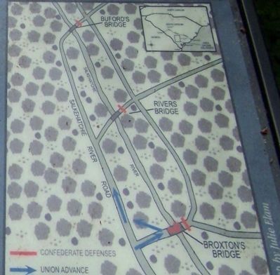
Regarding Battle of Rivers' Bridge. On the upper left is a drawing depicting the fighting. On the upper right, a map demonstrates
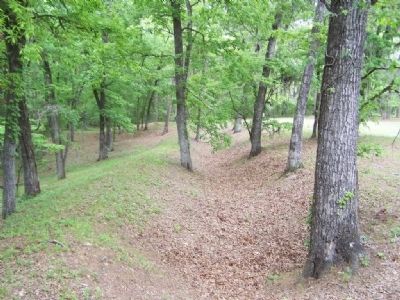
Confederates burned Braxton's Bridge, forcing Union troops to advance to the crossings upstream at Rivers and Buford's bridges. On the lower right a drawing illustrates At Rivers Bridge, troopers of the 3rd South Carolina Cavalry fought on foot from improvised foxholes called "rifle pits." Sgt. John A. Moore remembered being "scattered along the swamp in little squads."
Credits. This page was last revised on June 16, 2016. It was originally submitted on April 29, 2008, by Mike Stroud of Bluffton, South Carolina. This page has been viewed 1,562 times since then and 20 times this year. Photos: 1, 2, 3, 4. submitted on April 29, 2008, by Mike Stroud of Bluffton, South Carolina. • Craig Swain was the editor who published this page.


