Plymouth in Grafton County, New Hampshire — The American Northeast (New England)
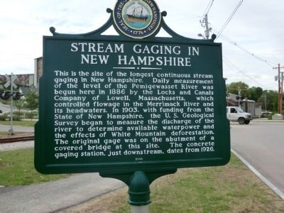
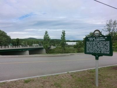
Stream Gaging in New Hampshire
Erected 2005 by New Hampshire Division of Historical Resources. (Marker Number 189.)
Topics and series. This historical marker is listed in these topic lists: Industry & Commerce • Waterways & Vessels. In addition, it is included in the New Hampshire Historical Highway Markers series list. A significant historical year for this entry is 1886.
Location. 43° 45.567′ N, 71° 41.183′ W. Marker is in Plymouth, New Hampshire, in Grafton County. Marker is on Green Street. Touch for map. Marker is in this post office area: Plymouth NH 03264, United States of America. Touch for directions.
Other nearby markers. At least 8 other markers are within walking distance of this marker. May 30, 1990 (about 600 feet away, measured in a direct line); Holmes Plymouth Academy (about 600 feet away); Capt. Harl Pease Jr. (about 600 feet away); Revolutionary War Cannon (about 600 feet away); Plymouth Town Hall & Bell (about 700 feet away); Plymouth Veterans Monument (about 700 feet away); The Common (approx. 0.2 miles away); Bobcat Boulder (approx. 0.2 miles away). Touch for a list and map of all markers in Plymouth.
Credits. This page was last revised on February 16, 2023. It was originally submitted on June 11, 2013, by Don Morfe of Baltimore, Maryland. This page has been viewed 570 times since then and 36 times this year. Last updated on June 19, 2014, by Kevin Craft of Bedford, Quebec. Photos: 1, 2. submitted on June 11, 2013, by Don Morfe of Baltimore, Maryland. • Bill Pfingsten was the editor who published this page.

