North in Mathews County, Virginia — The American South (Mid-Atlantic)
Fort Nonsense
Smart’s Mill/North End Mill Fortifications
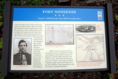
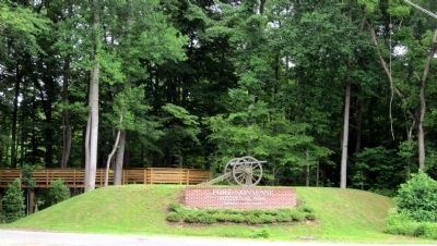
These earthworks are the remains of Fort Nonsense, first called the Smart's Mill or North End Mill fortification. Enslaved black laborers under the supervision of 2nd Lt. William Henry Clarke, an engineer who graduated from Virginia Military Institute in 1859, constructed the works in 1861. The fort was intended to block Union forces from advancing westward from the Chesapeake Bay through Mathews and Gloucester Counties toward the Confederate capital in Richmond. Never used as planned, the fortification became popularly known as Fort Nonsense.
Mathews County was important for its salt production and as a destination for Confederate blockade runners between Virginia and Maryland. In October 1863, Union Gen. Isaac J. Wistar and Lt. Cmdr. James H. Gillis led an army-navy task force to the county to eradicate Confederate supply trading and commerce raiding. Some of Wistar's troops camped here at what they called “an old Rebel breastwork.”
(captions)
(lower left) 2nd Lt. William H. Clarke Courtesy Virginia Military Institute Archives
(upper center) Provision Return for the men at Smart's Mill Courtesy National Archives and Records Administration
(upper right) U.S. Navy vessels pursuing a Confederate blockade runner, Harper's Weekly, Dec. 31, 1864
(lower right) "Position of U.S. Forces under General Wistar, to Cover Operations of Cavalry in Mathews County, Va., October 5-9, 1883," adapted from The War of the Rebellion: A Compilation of the Official Records of the Union Confederate Armies, Ser. I, Vol. 29, Pt. 1, p.1017
Erected 2014 by Virginia Civil WarTrails.
Topics and series. This historical marker is listed in these topic lists: Forts and Castles • War, US Civil. In addition, it is included in the Virginia Civil War Trails series list. A significant historical month for this entry is October 1863.
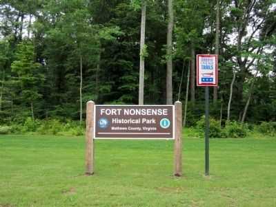
Location. 37° 28.015′ N, 76° 26.678′ W. Marker is in North, Virginia, in Mathews County. Marker can be reached from Windsor Road (Virginia Route 3) 0.2 miles north of John Clayton Memorial Highway (Virginia Route 14), on the right when traveling north. Located near the parking lot of Fort Nonsense Historical Park. Touch for map. Marker is in this post office area: North VA 23128, United States of America. Touch for directions.
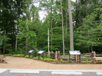
Other nearby markers. At least 8 other markers are within walking distance of this marker. By Land And By Sea (here, next to this marker); Mathews County (a few steps from this marker); Field Fortifications (within shouting distance of this marker); a different marker also named Fort Nonsense (within shouting distance of this marker); Civil War In Mathews County (about 400 feet away, measured in a direct line); John Clayton, Botanist (about 400 feet away); a different marker also named Civil War In Mathews County (about 400 feet away); a different marker also named Civil War In Mathews County (about 500 feet away). Touch for a list and map of all markers in North.
Credits. This page was last revised on November 10, 2021. It was originally submitted on June 22, 2014, by Bernard Fisher of Richmond, Virginia. This page has been viewed 679 times since then and 38 times this year. Photos: 1, 2, 3, 4. submitted on June 22, 2014, by Bernard Fisher of Richmond, Virginia.


