Near Escalante in Garfield County, Utah — The American Mountains (Southwest)
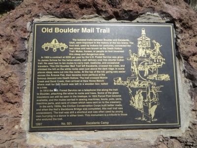
Old Boulder Mail Trail
In 1902 a contract at $200 per year by the U.S. Postal Service was given to James Schow for the twice-weekly mail delivery over the shorter Indian trail. He used two to ten mules to carry mail, medicine, and occasional travelers. This Old Boulder Mail Trail left Escalante, crossed the creek, and climbed the hill on the white rocks seen just above the dark ridge. In some places steps were cut into the rocks. At the top of the hill, going was easier across the Antone Flat, then became more perilous at the famous descent into Death Hollow. The trail crossed Mamie Creek and Sand Creek, then arrived at New Home Bench where mail for Salt Gulch was left in a wooden box nailed to a tree.
In 1910 the U.S. Forest Service ran a telephone line along the trail to Boulder, attaching the wires to rocks and trees. Some of the glass insulators can still be seen in the treetops. In 1924 Parcel Post became available, and the mules carried in sewing machines, boots, pots, pans, machine parts, and cans of cream which were sent on to the creamery.
In the early 1930s, the Civilian Conservation Corps built better roads, and when the Hell's Backbone Bridge was completed, this mail trail was unnecessary. The trail was still a shortcut and was often used by young men hurrying to a dance in either town. This monument is a tribute to those who endured the trail.
Erected 1997 by Escalante Camp, Daughters of Utah Pioneers. (Marker Number 501.)
Topics and series. This historical marker is listed in this topic list: Roads & Vehicles. In addition, it is included in the Civilian Conservation Corps (CCC), and the Daughters of Utah Pioneers series lists. A significant historical year for this entry is 1902.
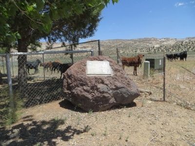
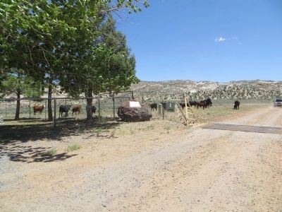
Location. 37° 45.862′ N, 111° 34.949′ W. Marker is near Escalante, Utah, in Garfield County. Marker is on Utah Route 12, on the left when traveling east. Marker is 1 mile east of town at the Escalante Cemetery. Touch for map. Marker is in this post office area: Escalante UT 84726, United States of America. Touch for directions.
Other nearby markers. At least 8 other markers are within 8 miles of this marker, measured as the crow flies. Old White Church (approx. one mile away); L.D.S. Tithing Office (approx. 1.1 miles away); First Public Building (approx. 1.1 miles away); Escalante (approx. 1.1 miles away); View from Head of the Rocks (approx. 7.1 miles away); Building the Million-dollar Road (approx. 7.1 miles away); Conserving Wildness (approx. 7.1 miles away); Granary in the Cliffs (approx. 7.8 miles away). Touch for a list and map of all markers in Escalante.
Credits. This page was last revised on June 16, 2016. It was originally submitted on June 24, 2014, by Bill Kirchner of Tucson, Arizona. This page has been viewed 594 times since then and 59 times this year. Photos: 1, 2, 3. submitted on June 24, 2014, by Bill Kirchner of Tucson, Arizona. • Syd Whittle was the editor who published this page.


