Hebron in Porter County, Indiana — The American Midwest (Great Lakes)
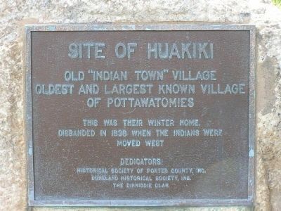
Site of Huakiki
Old "Indian Town" Village
Oldest and largest known village
of Pottawatomies.
This was their winter home.
Disbanded in 1838 when the Indians were moved west.
Dedicators:
Historical Society of Porter County, Inc.,
Duneland Historical Society, Inc.
The Dinwiddie Clan
Erected by Historical Society of Porter County, Inc., Duneland Historical Society, Inc., and the Dinwiddie Clan.
Topics. This historical marker is listed in these topic lists: Native Americans • Settlements & Settlers. A significant historical year for this entry is 1838.
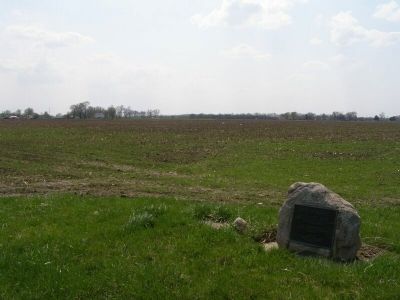
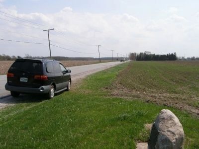
Location. 41° 17.64′ N, 87° 11.983′ W. Marker is in Hebron, Indiana, in Porter County. Marker is on U.S. 231, 0.3 miles north of State Road 2, on the right when traveling south. The marker is located about .3 miles north of the Indiana 2 corner, where West State Route 2 heads towards Interstate 69 and US 231 continues North/South between DeMotte and Hebron, Indiana. Touch for map. Marker is in this post office area: Hebron IN 46341, United States of America. Touch for directions.
Other nearby markers. At least 8 other markers are within 13 miles of this marker, measured as the crow flies. A different marker also named Site of Huakiki (approx. 5 miles away); Site of Tassinong (approx. 9.7 miles away); Wheatfield High School (approx. 10.4 miles away); Lake County Sheriff's House and Jail 1882 (approx. 12 miles away); Carnegie Center 1908 (approx. 12 miles away); The Old Lake County Courthouse, 1878 (approx. 12.1 miles away); Crown Point World War II Veterans Memorial (approx. 12.1 miles away); W.W.II Triangle Memorial (approx. 12.3 miles away).
Related marker. Click here for another marker that is related to this marker. Potawatomi Indian Village
Credits. This page was last revised on June 16, 2016. It was originally submitted on April 30, 2008, by Christopher Light of Valparaiso, Indiana. This page has been viewed 2,224 times since then and 64 times this year. Photos: 1, 2, 3. submitted on April 30, 2008, by Christopher Light of Valparaiso, Indiana. • Christopher Busta-Peck was the editor who published this page.


