Eads in Arlington in Shelby County, Tennessee — The American South (East South Central)
Old Stagecoach Inn
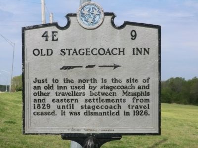
Photographed by Don Morfe, April 21, 2014
1. Old Stagecoach Inn Marker
Erected by Tennessee Historical Commission. (Marker Number 4E 9.)
Topics and series. This historical marker is listed in these topic lists: Industry & Commerce • Roads & Vehicles. In addition, it is included in the Tennessee Historical Commission series list. A significant historical year for this entry is 1829.
Location. 35° 12.648′ N, 89° 40.866′ W. Marker is in Arlington, Tennessee, in Shelby County. It is in Eads. It is at the intersection of U.S. 64 and Reid Hooker Road on U.S. 64. Touch for map. Marker is in this post office area: Arlington TN 38002, United States of America. Touch for directions.

Regionally, this marker is in West Tennessee and in Greater Memphis. It is also in the American South, specifically in the Deep South, in the Upper South, in the Mississippi Delta, and in the Great River Road Region. Globally, it is in North America, the Western Hemisphere, the Western World, and the Anglosphere.
this page online
Other nearby markers. At least 8 other markers are within 6 miles of this marker, measured as the crow flies: Gray's Creek Baptist Church / Gray's Creek Cemetery (about 300 feet away, measured in a direct line); Chambers Chapel United Methodist Church / Chambers Chapel Cemetery (approx. one mile away); Orion Hill (approx. 2.7 miles away); Memphis's Civil War Sites (approx. 3.8 miles away); a different marker also named Davies Manor (approx. 4 miles away); Ellen Davies-Rodgers (approx. 4 miles away); Dr. Greene Fort Pinkston (approx. 4½ miles away); Arlington, Tennessee (approx. 5.2 miles away). Touch for a list and map of all markers in Arlington.
Another marker is no longer nearby. Davies Manor (was approx. 4 miles away but has been confirmed missing).
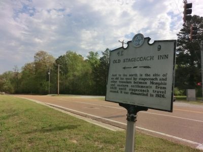
Photographed by Don Morfe, April 21, 2014
2. Old Stagecoach Inn Marker
Credits. This page was last revised on February 7, 2023. It was originally submitted on June 26, 2014, by Don Morfe of Baltimore, Maryland. This page has been viewed 1,738 times since then and 88 times this year. Photos: 1, 2. submitted on June 26, 2014, by Don Morfe of Baltimore, Maryland. • Bill Pfingsten was the editor who published this page.
