Sterling in Sanpete County, Utah — The American Mountains (Southwest)
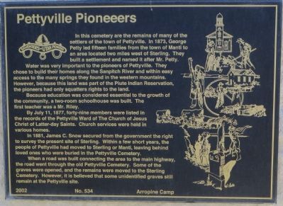
Pettyville Pioneers
Water was very important to the pioneers of Pettyville. They chose to build their homes along the Sanpitch River and within easy access to the many springs they found in the western mountains. However, because this land was part of the Paiute Indian Reservation, the pioneers had only squatters rights to the land.
Because education was considered essential to the growth of the community, a two-room schoolhouse was built. The first teacher was a Mr. Riley.
By July 11, 1877, forty-nine members were listed in the records of the Pettyville Ward of The Church of Jesus Christ of Latter-day Saints. Church services were held in various homes.
In 1881, James C. Snow secured from the government the right to survey the present site of Sterling. Within a few short years, the people of Pettyville had moved to Sterling or Manti, leaving behind loved ones who were buried in the Pettyville Cemetery.
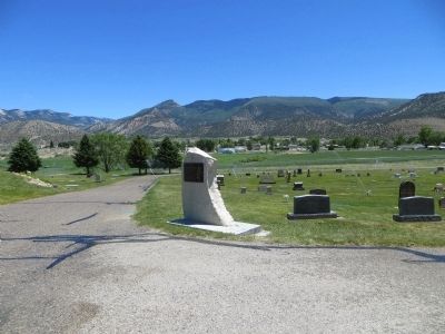
When a road was built connecting the area to the main highway, the road went through the old Pettyville Cemetery. Some of the graves were opened, and the remains were moved to the Sterling Cemetery. However, it is believed that some unidentified graves still remain at the Pettyville site.
Erected 2002 by Camp Arropeen, Daughters of Utah Pioneers. (Marker Number 534.)
Topics and series. This historical marker is listed in these topic lists: Cemeteries & Burial Sites • Settlements & Settlers. In addition, it is included in the Daughters of Utah Pioneers series list. A significant historical month for this entry is July 1865.
Location. 39° 11.769′ N, 111° 41.979′ W. Marker is in Sterling, Utah, in Sanpete County. Marker is on West Center Street, half a mile west of Main Street, on the right when traveling west. Touch for map. Marker is in this post office area: Sterling UT 84665, United States of America. Touch for directions.
Other nearby markers. At least 8 other markers are within 6 miles of this marker, measured as the crow flies. Sterling (approx. 0.4 miles away); Funk's Lake (approx. half a mile away); L.R. & Clara Anderson House (approx. 5.4 miles away); Mayfield Centennial (approx. 5.6 miles away); Manti Bell Tower (approx. 5.7 miles away); The First Presbyterian Church of Manti (approx. 5.7 miles away); Big Fort (approx. 5.8 miles away); Manti Carnegie Library (approx. 5.8 miles away). Touch for a list and map of all markers in Sterling.
Credits. This page was last revised on June 16, 2016. It was originally submitted on June 29, 2014, by Bill Kirchner of Tucson, Arizona. This page has been viewed 492 times since then and 30 times this year. Photos: 1, 2, 3. submitted on June 29, 2014, by Bill Kirchner of Tucson, Arizona. • Syd Whittle was the editor who published this page.


