Near St. Peter in Nicollet County, Minnesota — The American Midwest (Upper Plains)
Exploring the River Valley
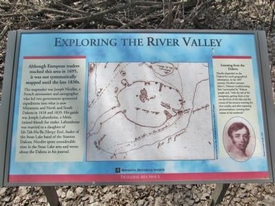
Although European traders reached this area in 1695, it was not systematically mapped until the late 1830s.
The mapmaker was Joseph Nicollet, a French astronomer and cartographer who led two government-sponsored expeditions into what is now Minnesota and North and South Dakota in 1838 and 1839. His guide was Joseph Laframboise, a Métis (mixed-blood) fur trader. Laframboise was married to a daughter of Ish-Tak-Ha-Ba (Sleepy Eye), leader of the Swan Lake band of the Sisseton Dakota. Nicollet spent considerable time in the Swan Lake area and wrote about the Dakota in his journal.
Learning from the Dakota
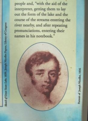
Nicollet depended on the Dakota for much geographical information. In his 1887 memoir, Nicollet's assistant John C. Frémont recalled seeing him "surrounded by" Dakota people and, "with the aid of the interpreter, getting them to lay out the form of the lake and the course of the streams entering the river nearby, and after repeating pronunciations, entering their names in his notebook."
Traverse des Sioux
Erected by the Minnesota Historical Society.
Topics and series. This historical marker is listed in these topic lists: Exploration • Native Americans. In addition, it is included in the Minnesota Historical Society series list. A significant historical year for this entry is 1695.
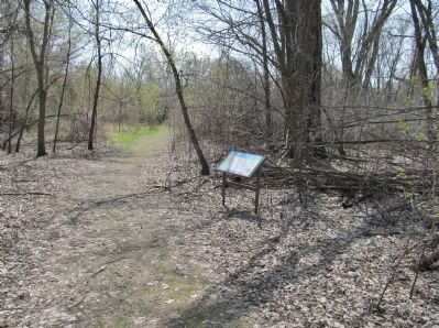
Location. 44° 21.274′ N, 93° 57.142′ W. Marker is near St. Peter, Minnesota, in Nicollet County. Marker can be reached from the intersection of North Minnesota Avenue (U.S. 169) and Dodd Avenue (State Highway 22), on the right when traveling north. Marker is near the end of an interpretive trail that is adjacent to the Nicollet County Historical Society Treaty Site History Center. Touch for map. Marker is at or near this postal address: 1851 North Minnesota Avenue, Saint Peter MN 56082, United States of America. Touch for directions.
Other nearby markers. At least 8 other markers are within walking distance of this marker. Fur Trader Louis Provencalle (about 700 feet away, measured in a direct line); A River Crossroad (approx. 0.2 miles away); The Old French Cemetery (approx. 0.2 miles away); The Treaty of Traverse des Sioux (approx. 0.2 miles away); Treaty of Traverse des Sioux Site (approx. 0.2 miles away); The Rush for Land (approx. 0.2 miles away); Treaty of Traverse Des Sioux (approx. 0.2 miles away); Ministering to the Dakota (approx. ¼ mile away). Touch for a list and map of all markers in St. Peter.
More about this marker. captions:
• Sketch of Great Swan Lake, 1839, Joseph Nicollet Papers, Library of Congress
• Portrait of Joseph Nicollet, 1836
Also see . . . Traverse des Sioux. Minnesota Historical Society website entry:
"For thousands of years, Traverse des Sioux was a crossroads and meeting place ... Traverse des Sioux soon grew up around the site with more than 70 buildings, including five taverns, two hotels and several churches. In 1856, however, nearby St. Peter was chosen as the county seat and by the late 1860s, nothing was left of the once-booming town of Traverse des Sioux." (Submitted on July 2, 2014.)
Credits. This page was last revised on July 24, 2023. It was originally submitted on July 2, 2014, by Keith L of Wisconsin Rapids, Wisconsin. This page has been viewed 554 times since then and 33 times this year. Photos: 1, 2, 3, 4, 5. submitted on July 2, 2014, by Keith L of Wisconsin Rapids, Wisconsin.
