Columbia in Maury County, Tennessee — The American South (East South Central)
Road to Nashville
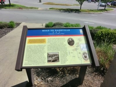
Columbia Artillery Duel
— Hood's Campaign —
In September 1864, after Union Gen. William T. Sherman defeated Confederate Gen. John Bell Hood at Atlanta, Hood led the Army of Tennessee northwest against Sherman’s supply lines. Rather than contest Sherman’s “March to the Sea,” Hood moved north into Tennessee. Gen. John M. Schofield, detached from Sherman’s army, delayed Hood at Columbia and Spring Hill before falling back to Franklin. The bloodbath there on November 30 crippled the Confederates, but they followed Schofield to the outskirts of Nashville and Union Gen. George H. Thomas’s strong defenses. Hood’s campaign ended when Thomas crushed his army on December 15-16.
(main text)
On November 26, 1864, as Confederate Gen. John Bell Hood’s army approached Columbia, he sent Gen. Stephen D. Lee’s corps to “demonstrate heavily” (feign an attack) against the Federal defenses on the south side of the town. Hood wanted Union Gen. John M. Schofield’s force to remain fixed in its entrenchments while his own men marched past Columbia to Spring Hill to sever Schofield’s route of retreat to Nashville. Lee’s infantrymen formed a long skirmish line extending about a mile to your right and a mile to your left. At the same time, he opened fire on the Union fortifications with part of his artillery here.
Some of the Federal guns were located in front of you on the present-day grounds of Maury Regional Hospital. They responded to Lee’s barrage with counterfire, beginning a furious and impressive artillery duel. Judge George Martin’s fine brick house, which stood on this site, was so riddled by Union solid shot that the outer walls later had to be propped up with log braces.
Despite the cannon fire and feigned infantry attack, Schofield’s men started to evacuate Columbia before the Confederates could turn their position and block the road to Nashville. During the night, the Federals quietly crossed the Duck River, then began marching north the next day. Gen. Jacob D. Cox’s division remained on the north side of the river to defend the crossing and delay Lee’s soldiers, who skirmished with the Union rear guard. The two forces would soon meet again at Spring Hill.
(captions)
(lower center) Entrenched Union artillery battery Courtesy Library of Congress
(upper right) Gen. John M. Schofield Courtesy Library of Congress
(lower right) Gen. Stephen D. Lee Courtesy Library of Congress
Erected by Tennessee Civil War Trails.
Topics and series. This historical marker is listed in this topic list: War, US Civil. In addition, it is included in the Tennessee Civil War Trails series list. A significant historical month for this entry is September 1864.
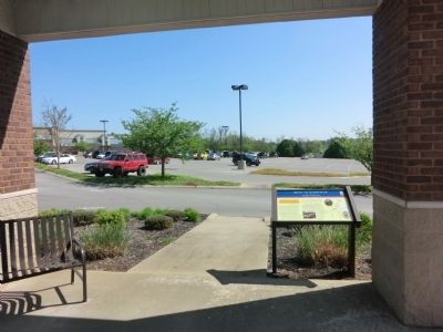
Location. 35° 35.963′ N, 87° 4.592′ W. Marker is in Columbia, Tennessee, in Maury County. Marker can be reached from Trotwood Avenue (Tennessee Route 243) 0.3 miles west of Country Club Lane, on the right when traveling west. The marker is located in the center circle of the Maury County Shopping Center parking lot. Touch for map. Marker is at or near this postal address: 1412 Trotwood Avenue, Columbia TN 38401, United States of America. Touch for directions.
Other nearby markers. At least 8 other markers are within 3 miles of this marker, measured as the crow flies. Hood and Schofield (approx. 0.7 miles away); Columbia Military Academy (approx. 1.7 miles away); Hood's Maneuver (approx. 1.7 miles away); Athenaeum Rectory (approx. 2.2 miles away); Union Station Train Depot (approx. 2.3 miles away); St. Peter's Church (Episcopal) (approx. 2.4 miles away); Columbia Fire Department (approx. 2.4 miles away); James K. Polk House (approx. 2½ miles away). Touch for a list and map of all markers in Columbia.
Credits. This page was last revised on June 16, 2016. It was originally submitted on July 4, 2014, by Don Morfe of Baltimore, Maryland. This page has been viewed 916 times since then and 47 times this year. Photos: 1, 2, 3. submitted on July 4, 2014, by Don Morfe of Baltimore, Maryland. • Bernard Fisher was the editor who published this page.


