Marker Logo HMdb.org THE HISTORICAL
MARKER DATABASE
“Bite-Size Bits of Local, National, and Global History”
Columbia in Maury County, Tennessee — The American South (East South Central)
 

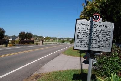
Advance and Retreat


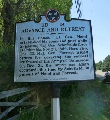
Advance and Retreat Marker image. Click for full size.
Photographed By Don Morfe, April 23, 2014
1. Advance and Retreat Marker
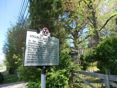
Inscription. In this house, Lt. Gen. Hood established his command post while bypassing Maj. Gen. Schofield's force at Columbia, Nov. 24, 1864. Here also, Dec. 20, Maj. Gen. Forrest issued orders for covering the retreat southward of the Army of Tennessee. On Dec. 21, the house was again occupied, this time by Schofield, in pursuit of Hood and Forrest.
 
Erected by Tennessee Historical Commission. (Marker Number 3D 18.)
 
Topics and series. This historical marker is listed in this topic list: War, US Civil. In addition, it is included in the Tennessee Historical Commission series list. A significant historical date for this entry is October 24, 1788.
 
Location. 35° 34.169′ N, 87° 2.575′ W. Marker is in Columbia, Tennessee, in Maury County. Marker is on Pulaski Highway (U.S. 31) 0.2 miles south of Sheegog Lane, on the left when traveling south. Touch for map. Marker is in this post office area: Columbia TN 38401, United States of America. Touch for directions.
 
Other nearby markers. At least 8 other markers are within 3 miles of this marker, measured as the crow flies. Joseph Brown (approx. 0.2 miles away); First County Seat Location (approx. 1.1 miles away); Jefferson Davis Monument (approx. 1.2 miles away); Elm Springs (approx. 1.3 miles away); Historic Elm Springs (approx. 1.3 miles away); Rose Hill Confederate Memorial
Paid Advertisement
Click on the ad for more information.
Please report objectionable advertising to the Editor.
Click or scan to see
this page online
(approx. 2.4 miles away); Lt. James C. Wooten, II (approx. 2.4 miles away); The Confederate Monument (approx. 2.4 miles away). Touch for a list and map of all markers in Columbia.
 
Advance and Retreat Marker image. Click for full size.
Photographed By Don Morfe, April 23, 2014
2. Advance and Retreat Marker
Headquarters Residence image. Click for full size.
Photographed By Don Morfe, April 23, 2014
3. Headquarters Residence
Advance and Retreat Marker image. Click for full size.
Photographed By Brandon Fletcher, October 14, 2011
4. Advance and Retreat Marker
Looking North
Advance and Retreat Marker image. Click for full size.
Photographed By Brandon Fletcher, October 14, 2011
5. Advance and Retreat Marker
Looking South
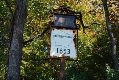
Warfield - Fuqua House 1853 Sign image. Click for full size.
Photographed By Brandon Fletcher, October 14, 2011
6. Warfield - Fuqua House 1853 Sign
Where General Hood established his command post.
 
 
Credits. This page was last revised on January 20, 2020. It was originally submitted on July 4, 2014, by Don Morfe of Baltimore, Maryland. This page has been viewed 1,030 times since then and 45 times this year. Photos:   1, 2, 3. submitted on July 4, 2014, by Don Morfe of Baltimore, Maryland.   4, 5, 6. submitted on October 5, 2015, by Brandon Fletcher of Chattanooga, Tennessee. • Bernard Fisher was the editor who published this page.
Share this page.  
Share on Tumblr
m=75040

CeraNet Cloud Computing sponsors the Historical Marker Database.
This website earns income from purchases you make after using our links to Amazon.com. We appreciate your support.
Paid Advertisement
Apr. 25, 2024