Marker Logo HMdb.org THE HISTORICAL
MARKER DATABASE
“Bite-Size Bits of Local, National, and Global History”
Sturgis in St. Joseph County, Michigan — The American Midwest (Great Lakes)
 

Sturgis Prairie


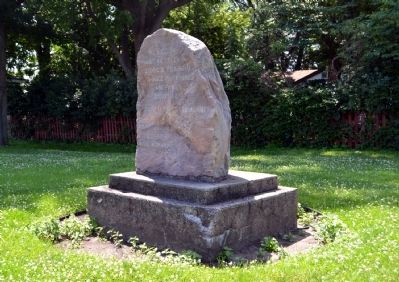
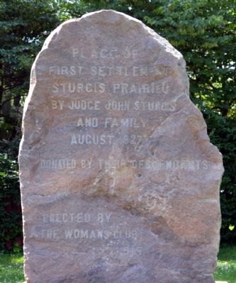
Sturgis Prairie Marker image. Click for full size.
Photographed By Duane Hall, June 27, 2014
1. Sturgis Prairie Marker
Inscription.

Place of
First Settlement
Sturgis Prairie
By Judge John Sturgis
And Family
August 1827

Donated by their Descendants

Erected by the Womans Club
1915

 
Erected 1915 by Sturgis Woman's Club.
 
Topics. This historical marker is listed in these topic lists: Settlements & SettlersWomen. A significant historical year for this entry is 1827.
 
Location. 41° 48.048′ N, 85° 24.275′ W. Marker is in Sturgis, Michigan, in St. Joseph County. Marker is at the intersection of E. Chicago Road (U.S. 12) and Pioneer Avenue, on the right when traveling east on E. Chicago Road. Touch for map. Marker is in this post office area: Sturgis MI 49091, United States of America. Touch for directions.
 
Other nearby markers. At least 8 other markers are within walking distance of this marker. Free Church Park (approx. 0.7 miles away); 100 E. Chicago (approx. 0.7 miles away); Sturges-Young Auditorium (approx. 0.7 miles away); 101 W. Chicago Rd. (approx. ¾ mile away); 103 W. Chicago (approx. ¾ mile away); Paving the Way to Progress (approx. ¾ mile away); 100 - 102 W. Chicago (approx. ¾ mile away); 107 W. West Street (approx. 0.8 miles away). Touch for a list and map of all markers in Sturgis.
 
Paid Advertisement
Click on the ad for more information.
Please report objectionable advertising to the Editor.
Click or scan to see
this page online
Sturgis Prairie Marker image. Click for full size.
Photographed By Duane Hall, June 27, 2014
2. Sturgis Prairie Marker
Sturgis Prairie Marker image. Click for full size.
Photographed By Duane Hall, June 27, 2014
3. Sturgis Prairie Marker
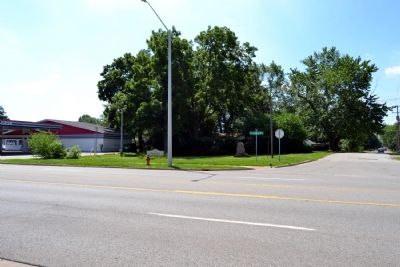
Located in Pioneer Park
Pioneer Park image. Click for full size.
Photographed By Duane Hall, June 27, 2014
4. Pioneer Park
View to southeast from across E. Chicago Road (US 12)
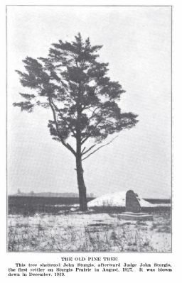
Sturgis Prairie Marker before 1920 image. Click for full size.
Photographed By Michigan History Magazine, Volume IV, 1920
5. Sturgis Prairie Marker before 1920
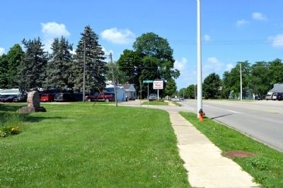
View to East Along E. Chicago Road (US 12) image. Click for full size.
Photographed By Duane Hall, June 27, 2014
6. View to East Along E. Chicago Road (US 12)
View to West Along E. Chicago Road (US 12) image. Click for full size.
Photographed By Duane Hall, June 27, 2014
7. View to West Along E. Chicago Road (US 12)
 
 
Credits. This page was last revised on June 16, 2016. It was originally submitted on July 4, 2014, by Duane Hall of Abilene, Texas. This page has been viewed 411 times since then and 24 times this year. Photos:   1, 2, 3, 4, 5, 6, 7. submitted on July 4, 2014, by Duane Hall of Abilene, Texas.
Share this page.  
Share on Tumblr
m=75057

CeraNet Cloud Computing sponsors the Historical Marker Database.
This website earns income from purchases you make after using our links to Amazon.com. We appreciate your support.
Paid Advertisement
Apr. 16, 2024