Spring Hill in Maury County, Tennessee — The American South (East South Central)
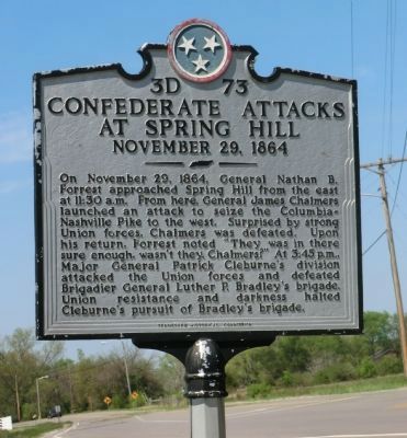
Confederate Attacks at Spring Hill
November 29, 1864
Erected by Tennessee Historical Commission. (Marker Number 3D 73.)
Topics. This historical marker is listed in this topic list: War, US Civil. A significant historical month for this entry is November 1864.
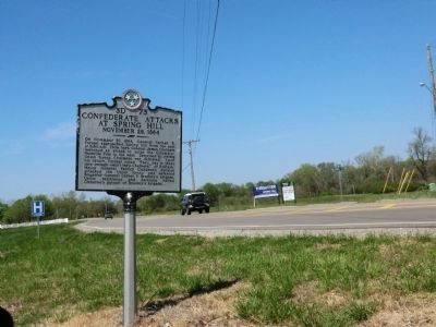
Location. 35° 44.235′ N, 86° 55.489′ W. Marker is in Spring Hill, Tennessee, in Maury County. Marker is on Kedron Road near Reserve Boulevard, on the right when traveling south. Touch for map. Marker is at or near this postal address: 3525 Kedron Road, Spring Hill TN 37174, United States of America. Touch for directions.
Other nearby markers. At least 8 other markers are within walking distance of this marker. Forrest's 3:00 p.m. Cavalry Attack (within shouting distance of this marker); Confederate Deployment (about 800 feet away, measured in a direct line); Federal Defense of Spring Hill (approx. 0.2 miles away); Cleburne's Attack (approx. 0.3 miles away); Cleburne's Pursuit (approx. 0.4 miles away); Ewell Farm (approx. 0.4 miles away); Left of the Union Defensive Position (approx. 0.4 miles away); Nashville and Decatur Railroad (approx. 0.4 miles away). Touch for a list and map of all markers in Spring Hill.
Credits. This page was last revised on January 20, 2020. It was originally submitted on July 5, 2014, by Don Morfe of Baltimore, Maryland. This page has been viewed 724 times since then and 11 times this year. Photos: 1, 2. submitted on July 5, 2014, by Don Morfe of Baltimore, Maryland. • Bernard Fisher was the editor who published this page.

