Near Fish Creek in Door County, Wisconsin — The American Midwest (Great Lakes)
Shorelines and Sedge Meadows
Weborg Point
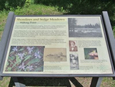
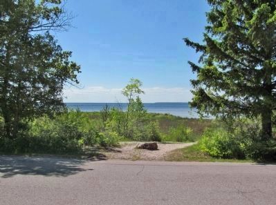
Peninsula's eight-mile shoreline is ever changing. Some years, a soggy cobblestone coast cradles sparse populations of unusual flowers. When water is high, crayfish thrive in crevices of the rocky coast, providing food for abundant smallmouth bass.
Here at Weborg Marsh, a wet "sedge" meadow adds more diversity. Sandhill cranes feed on snails and cattail tubers that live between clumps of tussock sedge. American redstarts nest in the brush along the wetland's edge. Nearby, shallow water provides spawning habitat for northern pike and yellow perch. The same resources that help wildlife survive today helped people survive long ago.
On the sedge meadow's eastern horizon stands a thick forest of cedar and spruce trees. It is part of 30-acre White Cedar Forest State National Area, established in 1952. Can you distinguish several tree-lined terraces? They mark abandoned beaches formed thousands of years ago by changing water levels in the Lake Michigan basin.
Increase Claflin and his kin settled here in 1842, pioneers in a changing land. A Claflin daughter married a Thorpe, forever connecting the two families. Asa Thorpe built the first pier in Fish Creek. The Thorpe-Claflin Cemetery lies at the edge of Weborg Marsh.
Topics. This historical marker is listed in these topic lists: Cemeteries & Burial Sites • Settlements & Settlers • Waterways & Vessels. A significant historical year for this entry is 1952.
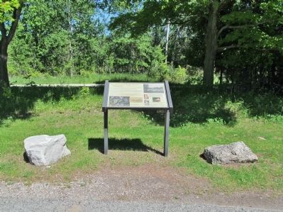
Location. 45° 8.141′ N, 87° 14.318′ W. Marker is near Fish Creek, Wisconsin, in Door County. Marker is on Shore Road, 0.8 miles north of Main Street (Wisconsin Highway 42), on the right when traveling north. Marker is northeast of Weborg Point in Peninsula State Park. Fee area; a vehicle admission sticker is required. Touch for map. Marker is at or near this postal address: 9462 Shore Road, Fish Creek WI 54212, United States of America. Touch for directions.
Other nearby markers. At least 8 other markers are within 2 miles of this marker, measured as the crow flies. Privilege in the Park (approx. 0.7 miles away); The Alexander Noble House (approx. 0.7 miles away); Niagara Escarpment (approx. 0.7 miles away); Town of Gibraltar (approx. 0.7 miles away); The Thorp Cabin (approx. 0.7 miles away); Church of the Atonement (approx. ¾ mile away); Why Green Bay? (approx. 1.2 miles away); Island Overlook (approx. 1.3 miles away). Touch for a list and map of all markers in Fish Creek.
More about this marker. captions:
• Weborg Point, Circa 1900.
• Dwarf lake iris blooms by early June. Colonies of this federally threatened plant thrive along Peninsula's ancient shorelines.
• In the early 1900s, a foot bridge offered precarious passage across Weborg Marsh.
• Increase Claflin
• The male American Redstart sports bright orange wing patches. It crafts a cup-shaped nest in the fork of a young tree. The nest, built of grass & bark shreds, is often lined with spider webs.
• Kathleen Klein displays a string of perch and one bass caught off Peninsula. Circa 1941.
Also see . . .
1. Peninsula Park White Cedar Forest. Wisconsin Department of Natural Resources website entry (Submitted on July 8, 2014.)
2. Door County. Increase Claflin. (Submitted on July 8, 2014.)
3. Peninsula Genealogical Society. Pioneer / Thorp Cemetery. (Submitted on July 8, 2014.)
Credits. This page was last revised on December 13, 2023. It was originally submitted on July 8, 2014, by Keith L of Wisconsin Rapids, Wisconsin. This page has been viewed 404 times since then and 18 times this year. Photos: 1, 2, 3. submitted on July 8, 2014, by Keith L of Wisconsin Rapids, Wisconsin.


