Blair Township near Hollidaysburg in Blair County, Pennsylvania — The American Northeast (Mid-Atlantic)
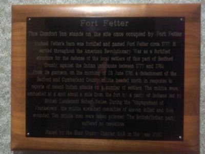
Fort Fetter
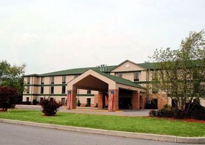
This Comfort Inn stands on the site once occupied by Fort Fetter.
Michael Fetter's barn was fortified and named Fort Fetter circa 1777. It served throughout the American Revolutionary War as a fortified structure for the defense of the local settlers of this part of Bedford County against the Indian incursions between 1777 and 1782. From its garrison on the morning of 03 June 1781, a detachment of the Bedford and Cumberland County militia headed north in response to reports of recent Indian attacks on a number of settlers. The militia were ambushed at a spot about a mile from the fort by a party of Indians led by British Lieutenant Robert Neiles. During the "Engagement of Frankstown", the militia sustained casualties of eleven killed and five wounded. Ten militia were taken prisoner. The British/Indian party suffered no casualties.
Erected 2000 by Blair County Chapter SAR.
Topics. This historical marker is listed in these topic lists: Forts and Castles • Native Americans • War, US Revolutionary. A significant historical date for this entry is June 3, 1781.
Location. 40° 25.95′ N, 78° 24.845′ W. Marker is near Hollidaysburg, Pennsylvania, in Blair County. It is in Blair Township. Marker can be reached from Patch Way Road. Located in the lobby of the Comfort Inn Duncansville. Touch for map. Marker is at or near this postal address: 130 Patch Way Rd, Hollidaysburg PA 16648, United States of America. Touch for directions.
Other nearby markers. At least 8 other markers are within 2 miles of this marker, measured as the crow flies. Jaycee Memorial Park (approx. 0.9 miles away); Canal Basin (approx. one mile away); Adam Holliday (approx. 1.1 miles away); The William Krelitz Building (approx. 1.1 miles away); First High School (approx. 1.1 miles away); John Blair (approx. 1.2 miles away); Pioneer Family (approx. 1.2 miles away); Civil War Memorial (approx. 1.2 miles away). Touch for a list and map of all markers in Hollidaysburg.
More about this marker. The text of this marker was composed by Larry D. Smith, Historian of the Blair County Chapter, Pennsylvania Society, SAR.
Additional commentary.
1. An additional, outside Plaque + Monument
Hello Mike & SAR;
SAR Comfort Inn, inside Plaque: By coincidence on February 15th, I had been looking, with no luck, for an outside, stone, Ft. Fetters Monument near Hollidaysburg, Blair County, PA that I had seen a picture of. I checked the internet and found Mike Wintermantels {SAR of Pittsburgh} write up on the fort dated the day before, February 14, 2012. Subsequently, I stopped in the Comfort Inn, found the plaque in the lobby, read it, and photographed it. It is a very nice article Mike and it is a very nice historical plaque. Thank you Mike & SAR {Sons of the American Revolution}.
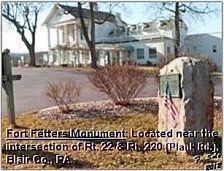
Location: An outside, stone, Ft. Fetters Monument: The Comfort Inn faces South. About 500+ feet in front of [South of} the inn is a white building, also facing South, on U.S. Rt. 22. It looks like a “white stone historical mansion” with a high porch roof supported by four, tall, impressive, stone pillars. It is now known as “The Olde Farm Office Centre.” It is located on U.S. Rt. 22 about Ό mile East of the intersection of U.S. Rt. 22 and Old U.S. Rt. 220 { Plank Road }. It is within the greater Duncansville boundaries. The Fort Fetters stone monument is near the highway on, or just East of, the immediate grounds of this “Olde Farm.”
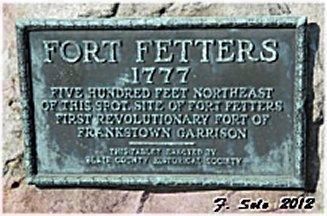
Monument Description: It is about 4 high x 2 wide x 1 thick with an impressive brass plaque on it. It reads:
1777
Five hundred feet northeast
of this spot, site of Fort Fetters
First Revolutionary Fort of
Frankstown Garrison
This tablet erected by
Blair County Historical Society
I thought readers, the SAR, and you might find this additional information interesting.
Thank you;
F. Solo March 13, 2012
— Submitted March 12, 2012, by F. Solo of Hollidaysburg, Pennsylvania.
Credits. This page was last revised on February 7, 2023. It was originally submitted on February 14, 2012, by Mike Wintermantel of Pittsburgh, Pennsylvania. This page has been viewed 2,505 times since then and 95 times this year. Last updated on July 9, 2014, by Larry D. Smith of East Freedom, Pennsylvania. Photos: 1. submitted on February 14, 2012, by Mike Wintermantel of Pittsburgh, Pennsylvania. 2, 3. submitted on March 12, 2012, by F. Solo of Hollidaysburg, Pennsylvania. 4. submitted on February 17, 2012, by Mike Wintermantel of Pittsburgh, Pennsylvania. • Bill Pfingsten was the editor who published this page.


