Oswego in Oswego County, New York — The American Northeast (Mid-Atlantic)
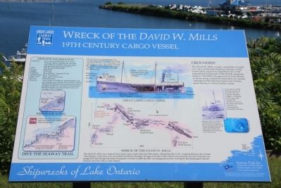
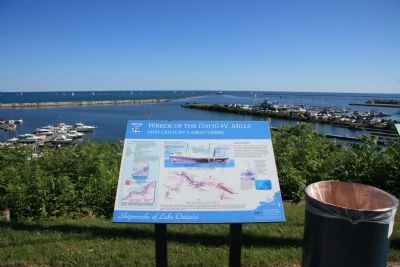
Wreck of the David W. Mills
19th Century Cargo Vessel
— Shipwrecks of Lake Ontario —
The David W. Mills, a cargo vessel that was part of a vast commercial shipping industry on the Great Lakes, played an important role in the industrial development of the north American interior. The Mills ran aground on Ford Shoals in dense smog created by forest fires in Canada. Attempts to free the boat failed and it broke apart during a violent October storm.
Wreck of the David W. Mills
The David W. Mills was a typical Great Lakes cargo vessel of the late 19th century. Measuring 202' by 34,' weighing 925 tons, this wooden "steambarge" could carry over one million board feet of lumber, though at the time of the wreck it was carrying coal. The wreck site was mapped by the Oswego Maritime Foundation. On May 3, 2000, the Mills was designated as New York State's first Submerged Cultural Preserve and Dive Site in Lake Ontario.
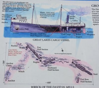
Great Lakes Cargo Vessel
The pilot house on steambarges was placed well forward, and the machinery was set in the stern, allowing cargo to be piled high on deck. This design initiated the distinctive look of the Great Lakes "lakeboat," which continued through the 20th century.
Masts - Early steam powered vessels still used wind power as a backup.
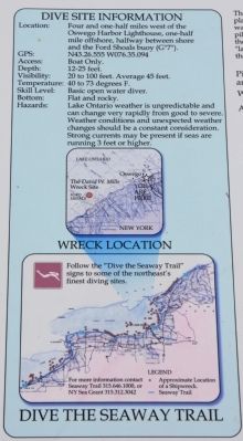
Dive Site Information
Location: Four and one-half miles west of the Oswego Harbor Lighthouse, one-half mile offshore, halfway between shore and the Ford Shoals buoy (G"7").
GPS: N43.26.555 W076.35.094
Access: Boat Only.
Depth: 12-25 feet.
Visibility: 20 to 100 feet. Average 45 feet.
Temperature: 40 to 73 degrees F.
Skill Level: Basic open water diver.
Bottom: Flat and rocky.
Hazards: Lake Ontario weather is unpredictable and can change very rapidly from good to severe. Weather conditions and unexpected weather changes should be a constant consideration. Strong currents may be present if seas are running 3 feet or higher.
Erected by Great Lakes Seaway Trail.
Topics and series. This historical marker is listed in these topic lists: Industry & Commerce • Waterways & Vessels. In addition, it is included in the Great Lakes Seaway Trail National Scenic Byway series list. A significant historical month for this entry is May 1895.
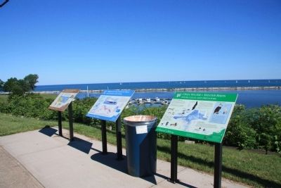
Location. 43° 27.734′ N, 76° 31.197′ W. Marker is in Oswego, New York, in Oswego County. Marker is at the intersection of Lake Street and Montcalm Street, on the left when traveling east on Lake Street. This historical marker is one of three panels of information prepared by the Great Lakes Seaway Trails, and
located on the high ground, in a small roadside park, overlooking Lake Ontario, along the north side of Lake Street. Touch for map. Marker is in this post office area: Oswego NY 13126, United States of America. Touch for directions.
Other nearby markers. At least 8 other markers are within walking distance of this marker. Oswego West Side Forts (here, next to this marker); Open Water = Winter Birds (a few steps from this marker); Oswego Harbor West Pierhead Lighthouse (about 600 feet away, measured in a direct line); Fort George (approx. 0.2 miles away); Oswego Harbor (approx. ¼ mile away); LT-5 TUG (approx. ¼ mile away); Fort Oswego (approx. 0.3 miles away); a different marker also named Fort Oswego (approx. 0.3 miles away). Touch for a list and map of all markers in Oswego.
Credits. This page was last revised on June 16, 2016. It was originally submitted on July 16, 2014, by Dale K. Benington of Toledo, Ohio. This page has been viewed 1,078 times since then and 40 times this year. Photos: 1, 2, 3, 4, 5. submitted on July 16, 2014, by Dale K. Benington of Toledo, Ohio.
