National Harbor in Fort Washington in Prince George's County, Maryland — The American Northeast (Mid-Atlantic)
Salubria Changed the Future of the Potomac Valley
Inscription.
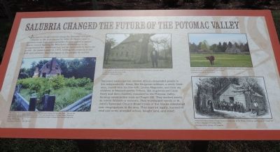
The nature of agriculture along the Potomac changed thanks to the techniques Dr. John H. Bayne used to produce fresh fruit and vegetables for the nation’s capital. Bayne ceased fighting for Maryland slaveholders to be compensated for emancipation, but he continued to serve the public. He passed away in 1870, leaving his property to his wife and children, and his legacy to the people he served.
Maryland emancipation allowed African-descended people to live independently. Some, like Benjamin Addison, a newly freed man, moved with his free wife, Louisa Magruder, and their six children to Massachusetts. Others, like Augustus and Linly Berry and their children, remained in the Potomac Valley, forming communities such as Chapel Hill. They worked mostly as tenant farmers or servants. They worshiped openly at St. John’s Episcopal Church Broad Creek, or free Blacks established new congregations in the area. They married legally, learned to read and write, attended school, bought land, and voted.
Photo captions:
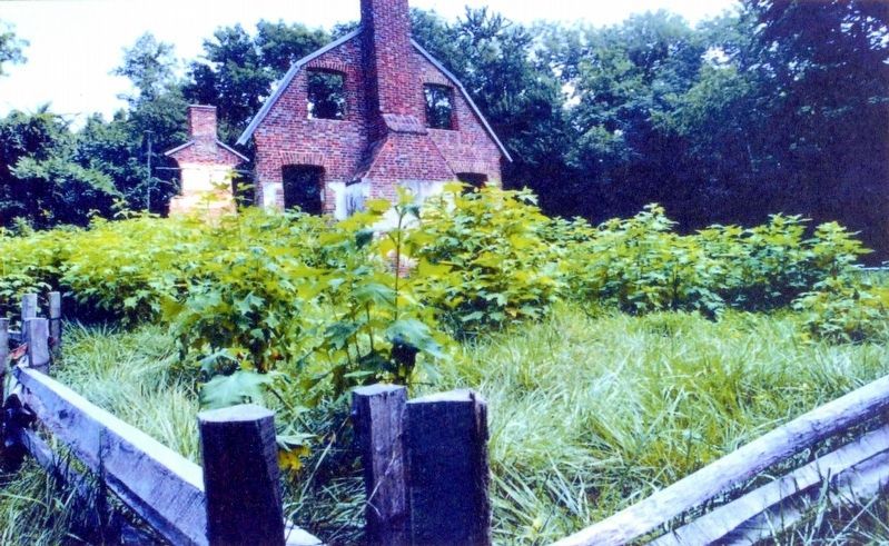
lower left: The ruins of “Want Water” mansion (1698-1700) still stand along the Potomac River. They are the Washington area’s oldest historic structure. From the ancient town of Broad Creek, Maryland, “Want Water” witnessed new towns and new peoples emerge in Alexandria, Georgetown and, today, Washington, DC.
Courtesy of the U.S. Park Service
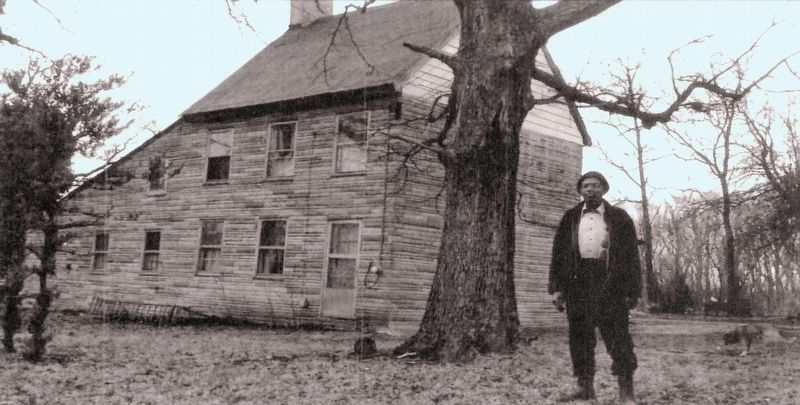
upper left middle: ”Next to Salubria stands the ‘Butler House’, a farm owned by free Blacks in the early 1850s. It is still owned by the family today.”
Courtesy of Washington Post.
“Cows similar to those bred by colonial settlers are presented as a public attraction at the famed Accokeek Foundation along the Potomac”
Courtesy of Accokeek Foundation
lower right: “Schools for the children of freed slaves included one at the African American community of Chapel Hill in Prince George’s Potomac Valley.”
Courtesy of the Library of Congress
Erected 2014 by Tanger Outlets: Experience Salubria.
Topics. This historical marker is listed in these topic lists: African Americans • Agriculture • Notable Places • Settlements & Settlers. A significant historical year for this entry is 1870.
Location. 38° 47.58′ N, 77° 0.217′ W. Marker is in Fort Washington, Maryland, in Prince George's County. It is in the National Harbor. Marker can be reached from Oxon Hill Road (Maryland Route 414) south of Tanger Blvd., on the right when traveling north. Touch for map. Marker is at or near this postal address: 7100 Oxon Hill Rd, Oxon Hill MD 20745, United States of America. Touch for directions.
Other nearby markers. At least 8 other markers are within walking distance of this marker. Judah and Resistance (here, next to this marker);
Slavery in the Potomac Valley (a few steps from this marker); Dr. John H. Bayne: A Leader In His Community (a few steps from this marker); Emancipation in Maryland (within shouting distance of this marker); Dr. John H. Bayne of Salubria “Prince of Horticulture” (within shouting distance of this marker); Front Door to Maryland History (about 600 feet away, measured in a direct line); John Hanson (about 700 feet away); Welcome to Salubria (approx. ¼ mile away). Touch for a list and map of all markers in Fort Washington.
Also see . . . The Butler House: Oxon Hill, MD. - early African American homestead - National Register of Historic Places, 2005 (Submitted on July 18, 2014, by Richard E. Miller of Oxon Hill, Maryland.)

Photographed By Allen C. Browne, April 14, 2018
4. Want Water
The ruins of Want Water Mansion (1698·1700) still standing on the Potomac River. They are the Washington area’s oldest historic structure. From the ancient town of Broad Creek, Maryland, Want Water witnessed new towns and new peoples emerge in Alexandria, Georgetown and, today, Washington, DC.Close-up of U.S. Park Service photo on marker
Credits. This page was last revised on March 3, 2023. It was originally submitted on July 17, 2014, by Richard E. Miller of Oxon Hill, Maryland. This page has been viewed 686 times since then and 23 times this year. Photos: 1, 2. submitted on July 17, 2014, by Richard E. Miller of Oxon Hill, Maryland. 3. submitted on July 18, 2014, by Richard E. Miller of Oxon Hill, Maryland. 4, 5, 6. submitted on April 22, 2018, by Allen C. Browne of Silver Spring, Maryland. • Bill Pfingsten was the editor who published this page.


