Franklin in Macon County, North Carolina — The American South (South Atlantic)
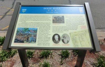
Dixie Hall
Surrender Scene
According to Lt. Col. William W. Stringfield of Thomas’s Legion, this part of North Carolina was the “most inaccessible portion of the Confederacy.” There was no telegraph system here, the mountains formed major impediments to transportation, and the nearest railroad was six miles east of Morganton. The Confederates here were among the last in the East to learn of Gen. Robert E. Lee’s surrender at Appomattox Court House, Va., on April 9, and Gen. Joseph E. Johnston’s surrender near Durham on April 26. Military clashes continued in this area, and parts of Thomas’s Legion and Col. William C. Bartlett’s 2nd North Carolina Mounted Infantry engaged Federal troops in Waynesville on May 6-7.
Union Col. George W. Kirk, who had raised the 3rd North Carolina, then advanced on Franklin. There, Capt. Stephen Whitaker commanded the “last body of organized army troops remaining east of the Mississippi, of all those whom the Confederacy sent into battle.” When Whitaker learned of the other capitulations, he surrendered his men here to Kirk, who paroled the Confederates and sent them home. After Kirk’s men occupied and looted Dixie Hall, young Alice Siler spat on Kirk’s flag from the upstairs porch.
(captions)
(lower left) Surrender at Dixie Hall, painting by Larry Calhoun Courtesy James J. Kirk II Collection
(upper center) Color postcard of Dixie Hall Courtesy Barbara McRae
(lower center) Col. George W. Kirk Courtesy Jane Gibson Nardy; Capt. Stephen Whitaker Courtesy Bruce Whitaker
(lower right) Partial list of Whitaker’s command, paroled by Kirk Courtesy NC Office of Archives and History
Erected by North Carolina Civil War Trails.
Topics and series. This historical marker is listed in this topic list: War, US Civil. In addition, it is included in the North Carolina Civil War Trails series list. A significant historical month for this entry is April 1917.
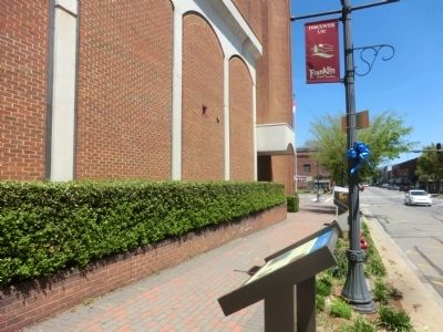
Location. 35° 10.91′ N, 83° 22.901′ W. Marker is in Franklin, North Carolina, in Macon County. Marker is on West Main Street (State Highway 28) east of Macon Avenue, on the right when traveling west. Touch for map. Marker is at or near this postal address: 43 W Main St, Franklin NC 28734, United States of America. Touch for directions.
Other nearby markers. At least 8 other markers are within walking distance of this marker. Thomas's Legion (a few steps from this marker); Macon County Confederate Memorial (within shouting distance of this marker); Battle of Echoe (within shouting distance of this marker); William Bartram Naturalist (within shouting distance of this marker); Gem Mining (within shouting distance of this marker); The North Carolina Bartram Trail (within shouting distance of this marker); Built in 1921 (about 300 feet away, measured in a direct line); Nikwasi Mound (approx. half a mile away). Touch for a list and map of all markers in Franklin.
Credits. This page was last revised on June 16, 2016. It was originally submitted on July 19, 2014, by Don Morfe of Baltimore, Maryland. This page has been viewed 791 times since then and 56 times this year. Photos: 1, 2. submitted on July 19, 2014, by Don Morfe of Baltimore, Maryland. • Bernard Fisher was the editor who published this page.

