North Concord in Granby in Essex County, Vermont — The American Northeast (New England)
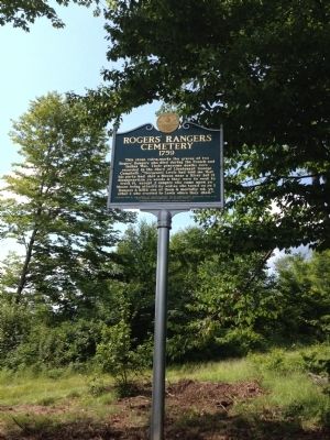
Rogers' Rangers Cemetery
1759
Photographed by Kevin Craft, July 21, 2014
1. Rogers' Rangers Cemetery Marker
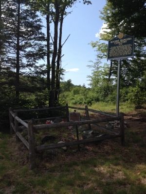
This stone cairn marks the graves of two Rogers' Rangers who died during the French and Indian War. Their gruesome deaths were recorded in the diary of Lieutenant George Campbell: "(Sergeant) Lewis had told me that his party had shot a Moose near a River but it disappear'd in ye woods & they were to weak to track it, except 3 rangers who came upon ye Moose being attack'd by wolves who turn'd on ye 3 Rangers & kill'd one of them & mortally wd. Ye other 2 who crawled to Lewis where they died."
Loescher, Burt G.: The History of Rogers' Rangers: The St. Francis Raid (Maryland, 202) p. 60. "Text printed with permission of Heritage Books, Inc."
Erected 2013 by Vermont Division for Historic Preservation.
Topics and series. This historical marker is listed in this topic list: War, French and Indian. In addition, it is included in the Vermont Division for Historic Preservation Markers series list.
Location. 44° 34.735′ N, 71° 45.806′ W. Marker is in Granby, Vermont, in Essex County. It is in North Concord. It is on Porrell Road 0.7 miles north of Granby Road, on the left when
this page online

Regionally, this marker is in the Connecticut River Valley and in the Northeast Kingdom. It is also in the American Northeast and in New England. Globally, it is in North America, the Great North Woods, the Western Hemisphere, the Western World, and the Anglosphere. Historically, it finds itself in what was once the Viceroyalty of New France and also the Vermont Republic.
Other nearby markers. At least 8 other markers are within 10 miles of this marker, measured as the crow flies: Lunenburgh Civil War Memorial (approx. 8.9 miles away); Lunenburg Veterans Memorial (approx. 8.9 miles away); Vermont (approx. 9.6 miles away); Mountain View Farm (approx. 9.7 miles away); Essex County Court House (approx. 10 miles away); a different marker also named Vermont (approx. 10 miles away); The Benton Cottage (approx. 10.1 miles away); Historic Guildhall, Vermont (approx. 10.1 miles away).
More about this marker. Marker and cemetery are located up an unpaved road (and all roads leading to Granby
Photographed by Kevin Craft, July 21, 2014
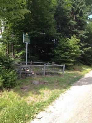
2. Rogers' Rangers Cemetery and Marker
Roger's Rangers
Buried Here
Date-10-1759
Vermont Hero's
Also see . . . Wikipedia - Rogers' Rangers. (Submitted on July 22, 2014, by Kevin Craft of Bedford, Quebec.)
Photographed by Kevin Craft, July 21, 2014
3. Rogers' Rangers Cemetery and Marker
Credits. This page was last revised on February 16, 2023. It was originally submitted on July 22, 2014, by Kevin Craft of Bedford, Quebec. This page has been viewed 3,165 times since then and 257 times this year. Photos: 1, 2, 3. submitted on July 22, 2014, by Kevin Craft of Bedford, Quebec. • Bill Pfingsten was the editor who published this page.
