Sonora in Tuolumne County, California — The American West (Pacific Coastal)
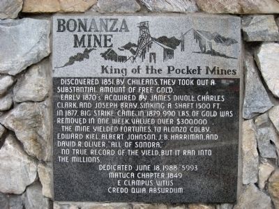
Bonanza Mine
King of the Pocket Mines
Early 1870's acquired by James Divoll, Charles Clark, and Joseph Bray, sinking a shaft 1500 ft. in 1877. Big strike came in 1879, 990 lbs. of gold was removed in one week, valued over $300,000.
The mine yielded fortunes to Alonzo Colby, Edward Kiel, Albert Johnson, J.B. Harriman, and David R. Oliver, "All of Sonora".
No true record of the yield, but it ran into the millions.
Erected 1988 by Matuca Chapter No. 1849, E Clampus Vitus.
Topics and series. This historical marker is listed in these topic lists: Environment • Industry & Commerce • Settlements & Settlers. In addition, it is included in the E Clampus Vitus series list. A significant historical year for this entry is 1851.
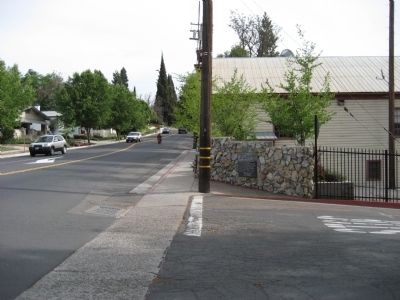
Location. 37° 59.398′ N, 120° 23.079′ W. Marker is in Sonora, California, in Tuolumne County. Marker is at the intersection of North Washington Street (State Highway 49) and School Road, on the left when traveling north on North Washington Street. Marker is on the southwest corner of the intersection, across the street from Sonora High School. Touch for map. Marker is in this post office area: Sonora CA 95370, United States of America. Touch for directions.
Other nearby markers. At least 8 other markers are within walking distance of this marker. Rother's Corner (approx. 0.2 miles away); Sonora IOOF Lodge No. 10 (approx. ¼ mile away); -Yo- Semite House (approx. ¼ mile away); Original Site of the Sonora Daily (approx. 0.3 miles away); Site of the First Office of The Union Democrat (approx. 0.3 miles away); Tuolumne County Albert N. Francisco Building (approx. 0.3 miles away); Tuolumne County Courthouse (approx. 0.3 miles away); Veterans Memorial Building (approx. 0.3 miles away). Touch for a list and map of all markers in Sonora.
Regarding Bonanza Mine. The Bonanza Mine underlies a portion of the city of Sonora. Buildings, most notably The Red Church, have reported recent settlement into the mines abandoned shafts and drifts.
Credits. This page was last revised on June 16, 2016. It was originally submitted on May 3, 2008, by Richard Wisehart of Sonora, California. This page has been viewed 2,683 times since then and 58 times this year. Photos: 1, 2. submitted on May 3, 2008, by Richard Wisehart of Sonora, California. • Christopher Busta-Peck was the editor who published this page.

