Saint-André-d'Argenteuil in Argenteuil, Québec — Central Canada (French-Canadian)
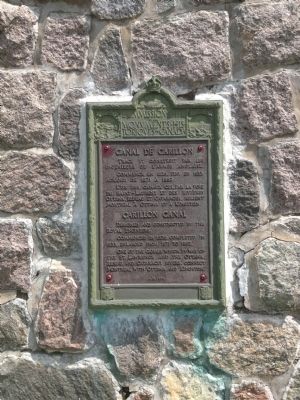
Carillon Canal
French text appears above English text.
Designed and constructed by the Royal Engineers. Commenced in 1826, completed in 1833, enlarged from 1871 to 1882. One of the canals which, by way of the St. Lawrence and the Ottawa, Rideau, and Cataraqui rivers, connect Montreal with Ottawa and Kingston.
Erected 1931 by Historic Sites and Monuments Board of Canada.
Topics and series. This historical marker is listed in this topic list: Waterways & Vessels. In addition, it is included in the Canada, Historic Sites and Monuments Board series list. A significant historical year for this entry is 1826.
Location. 45° 34.059′ N, 74° 22.54′ W. Marker is in Saint-André-d'Argenteuil, Québec, in Argenteuil. Marker is at the intersection of du Long-Sault Street (Québec Route 344) and du Parc Street, on the right when traveling west on du Long-Sault Street. Touch for map. Marker is in this post office area: Saint-André-d'Argenteuil QC J0V 1X0, Canada. Touch for directions.
Other nearby markers. At least 4 other markers are within 13 kilometers of this marker, measured as the crow flies. Le Pont Riguad-De Cavagnal (approx. 11.4 kilometers away); Église Sainte-Madeleine-de-Rigaud (approx. 11.4 kilometers away); L'Ancien Bureau de Poste (approx. 11.4 kilometers away); Le 125, Saint-Pierre (approx. 11.5 kilometers away).
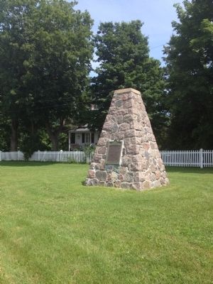
More about this marker. Marker is located across the street from the now-defunct canal and a stone's throw from the modern locks which allow boats to circumnavigate the Carillon Dam and hydro-electric generating station, of which tours are offered.
Also see . . . National Historic Site - Carillon Canal. (Submitted on July 25, 2014, by Kevin Craft of Bedford, Quebec.)
Credits. This page was last revised on January 23, 2022. It was originally submitted on July 25, 2014, by Kevin Craft of Bedford, Quebec. This page has been viewed 696 times since then and 46 times this year. Photos: 1, 2. submitted on July 25, 2014, by Kevin Craft of Bedford, Quebec. • Bill Pfingsten was the editor who published this page.

