Stafford in Stafford County, Virginia — The American South (Mid-Atlantic)
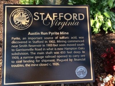
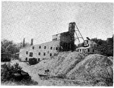
Austin Run Pyrite Mine
Stafford, Virginia
Erected 2014 by Stafford County.
Topics. This historical marker is listed in these topic lists: Industry & Commerce • Natural Resources • Railroads & Streetcars. A significant historical year for this entry is 1902.
Location. 38° 27.442′ N, 77° 25.471′ W. Marker is in Stafford, Virginia, in Stafford County. Marker can be reached from the intersection of Northampton Boulevard and Mine Road, on the right when traveling east. Located in front of the Hampton Oaks Community Center. Touch for map. Marker is at or near this postal address: 80 Northampton Blvd, Stafford VA 22554, United States of America. Touch for directions.
Other nearby markers. At least 8 other markers are within 2 miles of this marker, measured as the crow flies. The Robertson Quarry (approx. one mile away); Historic Knight Family Cemetery (approx. one mile away); The Robertson-Towson House (approx. 1.1 miles away); The Knight House (approx. 1.1 miles away); Peyton’s Ordinary (approx. 1.2 miles away); Truslow Family Cemetery (approx. 1.2 miles away); Aquia Church (approx. 1.2 miles away); Fleurries (approx. 1.2 miles away). Touch for a list and map of all markers in Stafford.
More about this marker. Unveiled on August 5, 2014. Part of Stafford's 350 Celebration
Also see . . . Pyrite Mining in Stafford County (MS Word document). (Submitted on August 15, 2014, by Kevin W. of Stafford, Virginia.)
Additional commentary.
1. Location on mine shaft
This marker should have been placed at the location of the mine shaft, which is actually about a half mile to the north of Hampton Oaks directly in front of Settlers Landing.
I did a report on this mine many years ago when I went to North Stafford High School. The actual plat and blueprints for the mine are in the Historical Documents section at the Stafford Courthouse library. That is where I got most of my information. I had a video and artifacts from the mine that I turned into my instructor Mr. Mclound. One was a horseshoe most likely for the mules they used in the mine shaft, and pictures of the mine shaft cable that at the time of my report was still in a backyard in the front of Settlers Landing. The dam in the creek near Settlers Landing was built to support the mine.
I hope this information is useful. This
is the first time I have seen this historical marker. I moved from the area in 2006 and just moved back in 2019. I grew up in Stafford from 1982-2005.
— Submitted June 29, 2021, by Michael Zollner of Stafford, Virginia.
Credits. This page was last revised on June 30, 2021. It was originally submitted on August 7, 2014, by Kathy Walker of Stafford, Virginia. This page has been viewed 1,164 times since then and 54 times this year. Photos: 1, 2. submitted on August 7, 2014, by Kathy Walker of Stafford, Virginia. 3. submitted on August 15, 2014, by Kevin W. of Stafford, Virginia. • Bernard Fisher was the editor who published this page.


