Santa Fe in Santa Fe County, New Mexico — The American Mountains (Southwest)
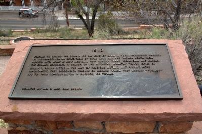
1540
— Commemorative Walkway Park —
Erected 1986 by Mr. and Mrs. Sam Ballen. (Marker Number 2.)
Topics. This historical marker is listed in these topic lists: Colonial Era • Exploration. A significant historical year for this entry is 1540.
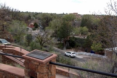
Location. 35° 41.353′ N, 105° 56.003′ W. Marker is in Santa Fe, New Mexico, in Santa Fe County. Marker can be reached from Paseo de Peralta near Otero Street. It is at Hillside Park. Touch for map. Marker is in this post office area: Santa Fe NM 87501, United States of America. Touch for directions.
Other nearby markers. At least 8 other markers are within walking distance of this marker. 1598 (a few steps from this marker); 500 A.D. (a few steps from this marker); 1848 (within shouting distance of this marker); 1610 (within shouting distance of this marker); 375th Anniversary of Santa Fe (within shouting distance of this marker); 1680 (within shouting distance of this marker); To the Future (within shouting distance of this marker); 1985 (within shouting distance of this marker). Touch for a list and map of all markers in Santa Fe.
Related markers. Click here for a list of markers that are related to this marker. This is a list of all 21 markers on Santa Fe’s Commemorative Walkway at Hillside Park. There is a link on the list to a map of all markers on the walkway.
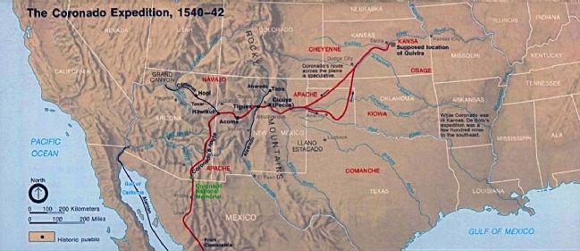
Also see . . . Wikipedia Entry for Francisco Vásquez de Coronado. “Hernando de Alvarado was sent to the east, and found several villages around the Rio Grande. Coronado had one commandeered for his winter quarters, Coofor, which is across the river from present-day Bernalillo near Albuquerque, New Mexico. During the winter of 1540–41, his army found themselves in conflicts with the Rio Grande natives, conflicts that led to the brutal Tiguex War. This war resulted in the destruction of the Tiguex pueblos and the death of hundreds of Native Americans.” (Submitted on August 11, 2014.)
Credits. This page was last revised on June 16, 2016. It was originally submitted on August 11, 2014, by J. J. Prats of Powell, Ohio. This page has been viewed 540 times since then and 17 times this year. Photos: 1, 2, 3. submitted on August 11, 2014, by J. J. Prats of Powell, Ohio.


