Santa Fe in Santa Fe County, New Mexico — The American Mountains (Southwest)
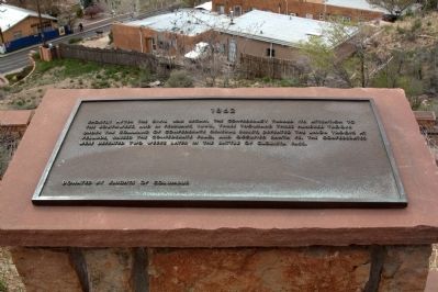
1862
— Commemorative Walkway Park —
Erected 1986 by Knights of Columbus. (Marker Number 11.)
Topics. This historical marker is listed in this topic list: War, US Civil. A significant historical month for this entry is February 1862.
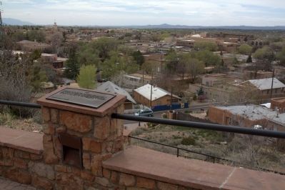
Location. 35° 41.379′ N, 105° 55.995′ W. Marker is in Santa Fe, New Mexico, in Santa Fe County. Marker can be reached from Paseo de Peralta near Otero Street. It is in Hillside Park. Touch for map. Marker is in this post office area: Santa Fe NM 87501, United States of America. Touch for directions.
Other nearby markers. At least 8 other markers are within walking distance of this marker. 1776 (here, next to this marker); 1692 (a few steps from this marker); 1912 (a few steps from this marker); 1680 (a few steps from this marker); 1926 (a few steps from this marker); 1945 (a few steps from this marker); 1960 (a few steps from this marker); 1976 (a few steps from this marker). Touch for a list and map of all markers in Santa Fe.
Related markers. Click here for a list of markers that are related to this marker. This is a list of all 21 markers on Santa Fe’s Commemorative Walkway at Hillside Park. There is a link on the list to a map of all markers on the walkway.
Also see . . .
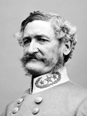
1. Wikipedia Entry for the Battle of Valverde. “The Battle of Valverde, or the Battle of Valverde Ford from February 20 to February 21, 1862, was fought near the town of Valverde” (no longer in existence) in present-day Socorro County 165 miles from Santa Fe, “at a ford of Valverde Creek in Confederate Arizona, in what is today the state of New Mexico. It was a major Confederate success in the New Mexico Campaign of the American Civil War. The belligerents were Confederate cavalry from Texas and several companies of Arizona militia versus U.S. Army regulars and Union volunteers from northern New Mexico and Colorado.” (Submitted on August 15, 2014.)
2. Wikipedia Entry for the Battle of Glorieta Pass. “The Battle of Glorieta Pass, fought from March 26 to 28, 1862 in northern New Mexico Territory, was the decisive battle of the New Mexico Campaign during the American Civil War. Dubbed the ‘Gettysburg of the West’ (a term that ‘serves the novelist better than the historian’) by some authors, it was intended as the killer blow by Confederate forces to break the Union possession of the West along the base of the Rocky Mountains. It was fought at Glorieta Pass in the Sangre de Cristo Mountains in what is now New Mexico, and was an important event in the history of the New Mexico Territory in the American Civil War.
“There was a skirmish on March 26 between advance forces from each army, with the main battle occurring on March 28. Although the Confederates were able to push the Union force back through the pass, they had to retreat when their supply train was destroyed and most of their horses and mules killed or driven off. Eventually, the Confederates had to withdraw entirely from the territory back into Confederate Arizona and then Texas. Glorieta Pass thus represented the peak of the campaign.” (Submitted on August 15, 2014.)
Credits. This page was last revised on June 16, 2016. It was originally submitted on August 15, 2014, by J. J. Prats of Powell, Ohio. This page has been viewed 573 times since then and 23 times this year. Photos: 1, 2, 3. submitted on August 15, 2014, by J. J. Prats of Powell, Ohio.


